The nice thing about blogging about your travels is that when you get suggestions from local guides, they know what you like and can steer you in the right direction. When John told me to check out Kasha-Katuwe Tent Rocks National Monument I knew this was a must-do. It’s about an hour southish of Santa Fe, but only 45 miles, so not a huge time or gas commitment.
Long-time readers will find today’s pictures look a tad familiar. Indeed. Today was much like being back in the Alberta Badlands around Drumheller or Writing-On-Stone Provincial Park. The hoodoos here look different, more like Bedouin tents than mushrooms, but the stratified cliffs and scrub brush around them had a definite feel of ‘home.’
The weather looked iffy this morning. The forecast said no rain, but it rained hard mid-morning for a bit. When I saw that it was clearing somewhat, I decided to go and hope for the best. I’d done some research and thought that there was only a couple of short and easy hikes there, but it turned out that one was actually quite challenging, with a steep ascent and some scrambling. I definitely wasn’t dressed for that, nor do I have any rain gear, but I made do. I need to replace my hiking kit, but wanted to wait to make sure the weight loss held before I invested. Let’s just say that a major shopping trip at Cabela’s is in store for me this summer… I need everything, including a new small pack with an internal frame and, of course, rain gear. I may have to cave in the next couple of days and go buy something cheap at Walmart just to get me home.
But at any rate, I left around 10:30 this morning and had a leisurely drive to the tent rocks monument. There was a bit on the interstate, but most of it wasn’t.
Let me pause here to say I took about 500 pictures today, but managed to trim it down to 57… 🙂

This vehicle made me laugh. The side of it had ‘Official TARDIS chaser’ painted on it and the license plate was T4RDIS.

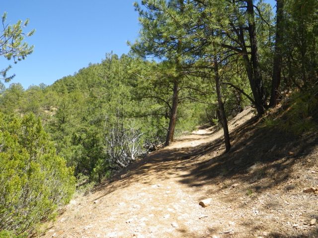
Entering the monument.
The fee station for the monument is about four miles before the parking lot. A Ranger took note of my pass number and gave me a receipt to leave on my dashboard as well as an information pamphlet. If you don’t have a pass, the cost is $5 per carload.

Very promising view from the parking lot.
The parking lot was a bit of a disaster, with parking spots poorly marked. I finally slid into a space that I could get out of easily and hoped for the best.

This little ball of rock dominates the landscape.
There are two trails, the gently sloping cave loop and the challenging canyon hike, which takes you through a narrow slot canyon, then has you scramble 630 feet in elevation to the top of the canyon for breathtaking views. I suggest doing the canyon hike then going back to the parking lot by the cave loop since that’s just an additional 0.2 miles.

I suggest doing the canyon trail, then returning to the parking lot by the cave loop.

The layers include sand and volcanic rock.
The tent rocks, or hoodoos, were formed from volcanic eruptions layering pumice, ash, and tuff.

First time I’ve seen a rest area before a trail. Had my lunch there!

Love the contrast of the greens and oranges.

Entering the slot canyon.

Looks like the cliff got attacked by a woodpecker!

Amazing that the tree is still standing.
The slot canyon bit of the hike was memorable and probably not for the claustrophobic.

Neat plant.

Cacti.
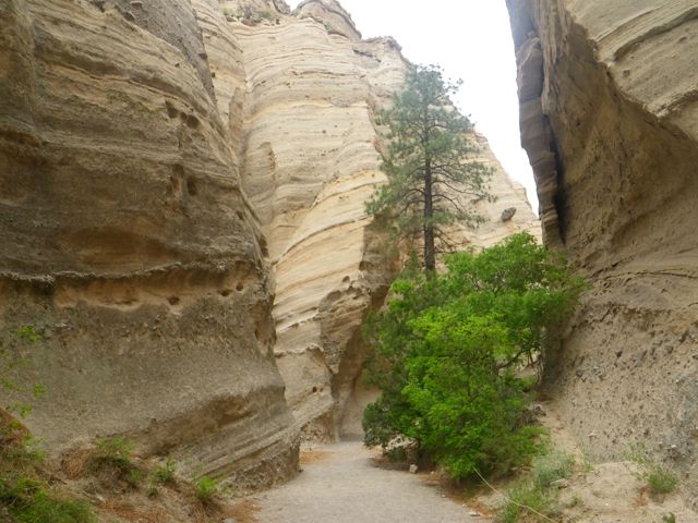
Going deeper into the slot canyon.

Narrow path!

Another neat dead tree.

Not feeling a strong urge to experience Vermilion Cliffs National Monument…

Not dressed for hiking, but at least I was comfortable!

The puddle was a fun obstacle to cross.

Looks like a castle with turrets.

This one looks like an evil gnome!

Some more hoodoos.
You eventually start to climb out of the slot canyon to its rim and the hike gets progressively harder.

Beautiful with a barren quality.

This tree seems to have something jackrabbit-like sitting in its branches.

Bit of a scramble.

Um, wow.

More flowers.

Look at them!

A lot of the trees here have twisted trunks like this one.
People started to turn back near the end, which was a shame. I can’t leave a trail unfinished and it wasn’t that hard, although there was one place where I had to pull myself up and my bad knee just would not follow the way it needed to and I thwacked it pretty hard on a boulder. I had to be extra careful after that, especially on the trip down, since the joint felt a little loose. Definitely time for me to shop for some sort of brace and I need to add hiking poles to my Cabela shopping list!

Climbing higher.

Still not at the top.

Prickly things.

These red flowers really popped.

Still climbing.

What a view!
I eventually got to a plateau that still wasn’t the top, but gave a good preview of what was to come if I kept going. Knee not withstanding, I was in good shape, just a little out of breath from the altitude, but not excessively so. This is good acclimatization for Colorado!

This hoodoo has a hole through it.

Another dead tree reincarnated as a statue.

Fuzzy flowers.

What a climb, but so worth it!

Such wide open country.

Cactus flower.
When I got to the top, I took a trail that went a little downwards to the very edge of a cliff and took a breather. I bought a watermelon yesterday (99 cents!) and a few cubes were exactly what I needed.

A much needed treat at the summit!

So huge.

Climbing down this bit was the end of the road. I’m standing just off from a sheer cliff edge.

Hard to believe I was one of those ants an hour or so before!
The trip down was slow. There was an older lady with a similar knee issue who got hurt at the same spot I did, so we watched out for each other all the way down.

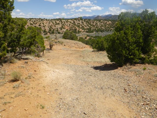
Heading back out.
It started to thunder and the sky looked ominous as I made my way back through the slot canyon. Seeing that I was picking up speed, a guy said quite rudely to me, ‘Relax, it’s just water.’ He obviously has never heard of flash flooding, nor did he read the signage at the trail head that said to get the hell out of the slot canyon in the exact conditions we were witnessing. Luckily, there was no rain!
I emerged from the slot canyon and took the cave loop back to the parking lot. At the junction of the two trails, it’s .5 miles to the parking lot the way I came or .7 by the cave trail

Colourful grass on the cave loop.
Low and behold, there was actually a cave on the trail!

Caveat (cave-ate) with soot on the ceiling.

Looking back to the cliffs.

This one looks like a mushroom.

Such interesting plants here!
This hike was a bit of a climb, but not a strenuous one.

Looked like a camp from afar!

This one looks evil. Can you see his eyes, nose, and creepy grin?
Back at the parking lot, I decided to drive the 3.5 miles to the Veterans’ Lookout. Imagine my shock that the road there was in very poor condition, almost as bad as the Isla road, and there was no warning about that! I was fine in my truck, but I feel bad for someone in a small car or, worse, an RV towing something since there’s no place to turn around until the top.
But the drive up was worth it!

View from the veterans’ lookout.

Surprisingly nice facility at the end of a terrible road.

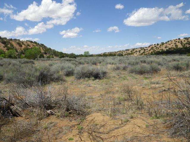
I love the vegetation around here.
What an utterly amazing and unexpected day! It just goes to show that you can research something and still not ‘get it’ without being on site. I had no idea that I would do such serious hiking today, and what a treat it was! Kasha-Katuwe Tent Rocks National Monument is a place of incredible power and definitely worth a half day trip from Santa Fe or a day trip from Albuquerque. You can still get a heck of a lot out of the monument even if you can’t hike. The cave loop is not challenging and a good part of it is wheelchair accessible. You can also hike a little ways into the slot canyon to get a feel for it even if you are not able to climb up .
Finally, I saw this car in a parking lot in town and fell in love with the colour. 🙂

What a pretty shade of orange!