I have mixed feelings about Tuesday. I’ll get the unpleasantness out of the way first. The weather was absolutely terrible and I was not equipped to be out in it. While we did get some patches of sun, most of the day was needling rain and slush. I wasn’t too badly off top-wise, with a good rain coat over my fleece hoodie, but sandals and jeans were not appropriate for my bottom half. I spent a lot of time in my truck looking out a amazing views, only running out for brief(ish) hikes during clearings. Last time I checked the forecast for the week, it was supposed to be sunny and in the high 60s to low 70s. The high today was around 50.
And despite this, I managed to spend six hours in the park and take over 200 photographs! Arches National Park is as amazing as I thought it would be!
I started the day after a second good night of sleep in a row. The cabin was super quiet, the temperature perfect (I had to run an oil filled radiator all night and sleep in fleece pants with socks), and it was dark. So when I woke up around 5:45, I was ready to start my day, which including schelpping down the hill to the bathroom in the dark in my jammies. Thankfully, no one else was up. 🙂
I then came back to the cabin, dressed, and put together my coffee stuff before going to the main building to use the kettle in the kitchen. There was only one other person and she was doing her own thing, so I sat at a table and composed my blog post from yesterday. By the time the dorm started to wake up, I’d done my most pressing online stuff and headed back to the cabin to get ready for my day.
I had picked up lunch stuff that didn’t need to be refrigerated, so I was able in the cabin to put together a few peanut and strawberry jam sandwiches (something I can eat several days in row without getting sick of it), a bag of nuts, an apple, and a granola bar, as well as water.
It was about 7:00 when I headed out and just shy of 7:30 when I hit the visitor’s centre at the park. The rain was really starting to come down so I made the decision to just drive the entire park road and visit all the view points without committing to any hiking. I had planned to only do short hikes today anyway and then do a longer one on the second and third days.
One thing I was very disappointed about was learning that I would not be able to do the ranger-led Fiery Furnace hike I was so eager to do. I had checked availability weeks ago for the morning hike you could buy online and they were full. The other option was to show up at the park in person and try to join a hike that afternoon. As I understood it, the afternoon hikes were first come, first served. So I thought that being so early today would get me in. Nope. All the hikes clear to next week were booked. 🙁 I’m just not made for this sort of travel where you have to book six to twelve months in advance. It’s the same thing with the Canadian national parks system.
My tour of the park is below in the gallery. When I was done, coming out of Landscape Arch with needling sleet falling, I’d been in the park for six hours and decided I was done. I went into Moab and found the museum. It’s pretty small, but I learned a lot about the history of the area. Post continued below the gallery.
-

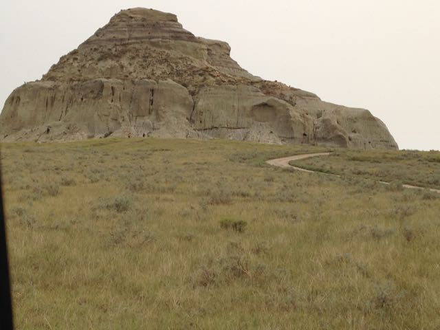
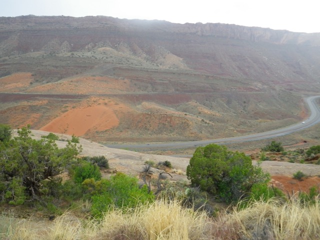
- After climbing up from the visitors’ centre, you see the Moab Fault.
-

- Visitors’ Centre below
-
- Visitors’ Centre below


-

- The nasty weather made for atmosphere.


-

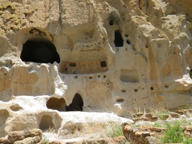
- The sand dunes are called “petrified,” which is a misnomer.

-

- The sand dunes are just regular sand that turned to stone.


-

- First glimpse of balanced rock.

-

- Balanced Rock had a friend named “Chip Off the Old Block”
-

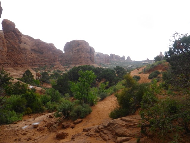
- First hike of the day. So wet!

-

- Back of Balanced Rock.


-

- Second hike of the day, Windows Trail
-

- This stone looks like an ancient elongated skull like I saw in Mexico.
-

- Or an alien. Am I the only one seeing this?!
-

- Windows Arch.


-

- I went through the Windows Arch to continue on more “primitive” trail.
-

- Follow the cairns!


-

- Not lost yet.
-

- I must have been here five minutes trying to figure out where to go.
-

- The weather was gorgeous while I was hemming and awing, the only nice five minutes we had all day.
-

- Ah, the trail goes that way!


-

- Stuck again.
-

- I think I have to go up.
-

- Yup, pretty sure I have to go up.
-

- Up I went.


-

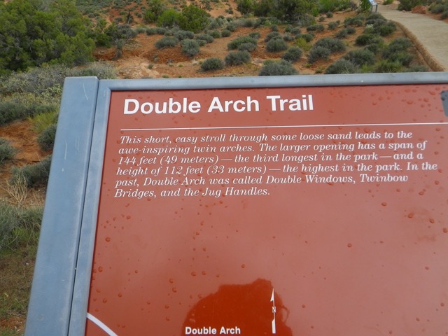
- Double Arch is not a misomer!
-

- This is the most famous arch in the park.
-

- I might do the hike to get closer to it.

-

- Cactus with red flowers.

-

- Different red flowers.


-

- Paths are really well done.


-

- Here I am at the other Delicate Arch viewpoint. Quite a climb. The arch is behind me off in the distance!
-

- Bunny.
-

- Coming back from the higher Delicate Arch viewpoint
-

- The ochre colour of this hill was quite a contrast to the rest of the landscape.


-

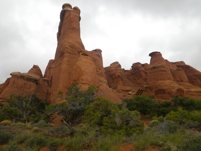
- Sandstone fins.


-

- Might as well do both!
-

- Into the fins.

-

- Newport Keens suck in sand — I have to really clean my toes after, otherwise I get blisters from the sand rubbing.
-

- Hmm…
-

- Recently, a huge chunk of the arch fell.
-

- Sand Dune Arch.


-

- On to the Broken Arch, which is not broken.


-

- Broken Arch.
-

- The trail goes through the arch, but I didn’t go on since it was raining again and I was frozen solid.

-

- There are a lot of these dead twisted trunks in the park.

-

- The bright green was a nice contrast.


-

- This is the end of the paved road.


-

- Might as well do both…
-

- Tunnel Arch


-

- Pine Tree Arch


-

- On my way to the Landscape Arch


-

- Oh… Last Arch of the day and the pièce de resistance.


-

- Once last glimpse. 25 years ago, a huge chunk fell from it and now hikers are not allowed anywhere near the arch.


-

- This is where I had dinner my first night in Moab. Very good food and attentive service!
-

- Moab Museum
-

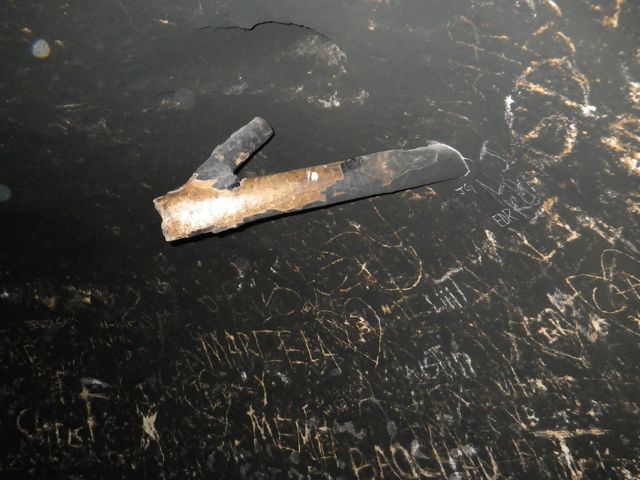
- This atlatl reminded me of my time in Yukon since I tried using one at the Berengia Centre in Whitehorse. I was very good!

-

- This container held irradiated water, whch was considered a cure-all!
-

- A sign in French was a welcome sight. 🙂
-

- This amazing topo map was made with fine layers of balsawood and took 20 years to create!

-

- Grinding corn.
-

- An imposing dinosaur.

-

- A sauropod femur.
-

- Sauropod eggs.
I went back to the hostel for a rest after and paid for a third night. I think that will be it because today, Wednesday, is the only clear day and it’s back to crud for the rest of the day. Two days in the park is going to be plenty. I’ll decide this afternoon.
Even though I spent a lot of time in the truck yesterday, I also hiked closed to 10KM (it adds up!) and I needed a proper stick-to-my-ribs dinner. I settled on the Moab Diner where I had an adequate hamburger steak dinner at a reasonable price. Service was very fast and very friendly. I can understand why it’s such a popular spot!
Since internet access is dismal at the hostel, even right in the main building, I decided to call it a night early and get up extra early to have breakfast at McDonald’s, where I am now. I’m trying to decide on which of two longer hikes I’m doing today and about to head out. The weather is already lovely at just shy of seven!