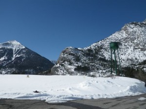
In the summer, the Dempster highway ends in Inuvik. In the winter, it continues as an ice road to the hamlet of Tuktoyaktuk (“looks like a caribou”). Located only about 100km from Inuvik on the edge of the Beaufort Sea, Tuk is home to a few hundred Inuvialuit habitants who keep their traditional ways alive. Touring the hamlet, whether you get there by plane, boat, dog sled team, or snowmobile, is one of the most popular things to do when visiting Inuvik, if only for the opportunity to dip one’s toe in the Arctic Ocean.
As I said, I picked Arctic Adventure tours to get me to Tuk since the other option didn’t have as many other tours happening. I am very satisfied with my experience. I know other members of the tour were not and I think that the reason for that is they just aren’t used to how things are done in the north. What may look like disorganization to an outsider is actually flexibility in the face of the weather or missing supplies. Living up here has really taught me to be more mellow and just let things come to me in their own time.
While there weren’t enough people for a tour on Wednesday, there were too many off us on Thursday. It was quite possibly the biggest group ever sent to Tuk at one time and I was a bit worried that we’d miss out on things, like the toe dipping, with a group that size. But I said nothing, allowing the trip to unfold, which it did in a most satisfactory manner.
The group was driven by minivan to Inuvik airport where we were loaded into a tiny plane. As each person got on, the tail of the plane began to sink nearer and nearer to the ground. I don’t think we could have stuffed one more person into that thing!
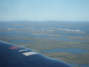
It took about a half hour to fly to Tuk. We got amazing aerial views of the Mackenzie Delta, Inuvik, pingos, and Tuk. I didn’t learn my lesson the last time I flew in a small aircraft and still took a lot of pictures, which meant that I was bright green when we landed. I just about kissed the ground. 😀

first good glimpse of Tuk
There were two guides waiting for us in Tuk, one older lady and one about my age. The former would take a dozen people in her van while the latter would take three in a pickup truck. I managed to get onto the small tour with a couple about my age, escaping the older German crowd.
We hadn’t even left Tuk airport that we learned our guide was born and raised in Tuk, has lived Outside, and has decided to put down her roots here. She is Inuvialuit, raised in the traditional ways, and a competent whale and caribou hunter. Most Inuvialuit her age do not have that level of competency with the old skills and passing them on to her son is very important to her. She can’t imagine any other place but Tuk where she can live the life she grew up with, eat the foods she is accustomed to, and be with those she loves.
I’m going to make a parenthesis here to gloss over a thorny Canadian issue: that of our First Nations people. While Canada has made great strides in this regard, the fact that we still have a department of Northern and Indian Affairs speaks to great lengths about how the First Nations are treated here. That said, a great portion of the Arctic is now within the Inuvialuit Settlement Region, leading from an agreement to return to the Inuvialuit people some of what was taken from them by European settlers. They now have complete control over their land and can manage its resources as they see fit. This issue came up many times during our Tuk visit.
Our guide took us around Tuk very slowly, showing us the key features of the community. The first thing we saw was an old warning station dating from the Cold War. It is still in use today, but largely automated. Her brother, based in Cambridge Bay, gets to come home once in a while and do maintenance work.
We then stopped at a pingo. A pingo is a mound of earth covered ice that only forms in a permafrost area, resulting from the waterbasin below being pushed up. Tuk is home to the largest concentration of pingos in the world and boasts the second largest (which is not the one we stopped at, but I did get a shot of it from the air). Since we were such a small group, we were able to get out of the truck and climb to the top of the pingo to get some good views of town. Looking at my photos, what strikes me is how much more picturesque Tuk looks in them than it did in person.

on top of the pingo
Back in the truck, we passed a summer smoke house, the baseball field, and three churches! The guide wanted to show us the second one, but it was being renovated, so we stopped in the third. From the outside it seemed quite derelict, but the damp interior was cozy and obviously well loved and used often. I admired a piece of patchwork made from seal fur, with the different colours coming from different parts of the seal.
And then came the highlight of the tour!

standing in the Arctic Ocean!
I can now say that I have touched all three of Canada’s coasts! The icing on the cake was the jelly fish washed up on shore.
Our guide mentioned that Tuk is one of the only coastal communities in the NWT to get a lot of driftwood (it floats up from the Mackenzie), so they have a constant supply for fires, building, tool-making, and crafts.
Next, the guide took us to the fur shop, where locals crafts are made available for sale. I really wish I’d had room in my budget for a pair of beaded slippers (moccasins where I come from). I still own the pair that were made for me as a child, but they obviously don’t fit any more!
The next part of the Tuk tour isn’t for the faint of heart. We got to descend 30 feet underground into the community freezer.

looooong way down
Hmm… I don’t like heights or enclosed places, but how often am I going to have the chance to see what permafrost looks like???
At the bottom, there are three hallways with about 25 rooms each. The ice house isn’t used much anymore (“Just about everyone has their own freezer”), but the guide’s father still uses his. I was able to go in and see what he keeps in there, including a whole seal used for dog meat.
The freezer has to be cleared out in early fall, soon as the snow comes. This is because snow is such a good insulator that it actually gets warm down in the ice house and everything melts in winter!
We climbed back up and I was never so grateful to see blue sky again. 😀 Three days later and I’m still sore from the climb!
Back in the truck, we saw some of the community infrastructure. There is a grocery store/pharmacy/gas bar/post office. A gallon jug of milk is about $15 and gas is about $2.50 per litre (about $10 per gallon). Our guide says that the cost of gas for boats and shells for rifles makes hunting cost nearly as much as buying groceries.
The town has no bank (“most people here wouldn’t even know what to do with one”), so the grocery store cashes cheques. Mail isn’t reliable, but does arrive eventually. Many residents buy things online and our guide laughed as she said that folks are quick to find places with cheap shipping that are then exploited until the sellers wise up and increase prices. You can get anything to Tuk, it’ll just cost ‘a little more’ than it does Outside. There is also satellite television, cell service, and high speed internet.
Tuk also has a nurse-staffed clinic open only for emergencies (they are short-staffed), a fire hall run by volunteers, an RCMP detachment with four officers who come in on two year rotations, and a taxi service that doubles as an ambulance (Suburban van=place for a patient to lie down in the back if needed), but there are no restaurants although there are a couple of bed and breakfasts. There is talk of turning one abandoned building into a small café.
There is a school, kindergarten through grade 12, from which our guide graduated, although she did do some of her schooling Outside. The older grades used to be shipped to Inuvik and the guide said that that was better since the Tuk school only offers the most basic courses. She had to do her sciences by correspondence and plans to send her son Outside to make sure he gets the best opportunities possible. Her biggest critique is of the retired teachers who come up just for the money and who are not willing to provide badly needed extra curricular activities. Aurora College, a post-secondary institution, has a small branch in Tuk, also.
Tuk also has a community centre, a swimming pool, and a youth centre. The pool is staffed only by Outsiders and is frequently closed because of lack of staff. There is talk of training a local person to do this job as it would be much more sensible and cost effective.

garlic-shaped building is a swimming pool
The youth centre has an interesting history. Back in the mid-1990’s the Molson company staged a major rock concert up in Tuk as a publicity stunt, with four big bands coming up to play. One of these bands, Metallica, donated the money for the youth centre. How cool is that?!
Next, our guide generously took us to her parents’ property to introduce us to the sled dogs, give us a demonstration in the use of a whale harpoon, and show us where the family prepares some of their traditional foods. We also saw her mother’s flowers; she is the only person in Tuk to grow flowers in her garden.
The tour ended at the docks where we saw a cargoship headed for other coastal communities. We’d been in a Tuk a full two hours and it was time to head back to the airport. On the way there, I asked our guide about a road I had seen from above that appeared to head well out of town. Turns out that it leads to a good source of gravel, but that there are talks of extending it as an all-year road to Inuvik! The hold up is that the easiest and cheapest route goes through the boundary of a sacred lake that would be polluted if made too accessible. Our guide is certain that the issues will be resolved and that she will see the completion of the road in her lifetime. An all-year road to Tuk would change life there dramatically and, according to our guide, for the better.
The flight back to Inuvik was much smoother and shorter than the flight in, so I felt more elated than nauseated when we landed. 🙂
My trip to Tuk cost $400 and was well worth both the cost and the anticipation. I’ve been wanting to do that trip for so long and it was even better than I had dreamed it would be. Traveling to Tuk is one of the cheapest excursions out of Inuvik and is a truly rewarding experience.

the minivan that took us to the airport

our plane, the tail of which lowered considerably as each one of us got on

cramped quarters 🙂

Inuvik airport

Inuvik airport

this puny plane made ours look slightly more respectable

takeoff over the Mackenzie Delta

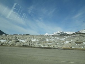
the Dempster

the Dempster

Inuvik

Inuvik

Inuvik

Inuvik

flying over the Mackenzie Delta

flying over the Mackenzie Delta

flying over the Mackenzie Delta

flying over the Mackenzie Delta

flying over the Mackenzie Delta

flying over the Mackenzie Delta
first glimpses of Tuk

the second largest pingo in the world

approaching Tuk

the Arctic Ocean!

the Arctic Ocean!

the Arctic Ocean!

first good glimpse of Tuk

Tuk airport

James Gruben summed up as a fun guy.

James Gruben

our guide was actually able to pronounce the Inuvialuit name

a Cold War era monitoring centre (remember, we’re practically on top of Russia here!)

exterior of the housing authority

just a normal little village, with street names, houses, even stop signs

on top of the pingo

on top of the pingo

on top of the pingo

on top of the pingo

summer smoke house

the baseball field

this church is being restored

this church is most definitely not abandoned!

the cozy interior of the church belies its weathered exterior

seal pelt/fur patchwork


Trans Canada trail marker

looking out at the Beaufort Sea

jellyfish!

standing in the Arctic Ocean!

exterior of the ice house entrance

exterior of the fur shop, which holds local crafts


looooong way down


fish

cut up bits of flesh

seal (used to feed the dogs)

crystallin snow

permafrost

looooong way up

base of the ladder

grocery store, gas bar, and pharmacy; also serves as a bank of sorts

the fire hall

the school (K thru 12)

the community centre

garlic-shaped building is a swimming pool

our guide explains the whale harpoon; the orange ball is keeps the whale carcass afloat

looking out towards the main part of Tuk

the guide’s family cuts up meat on that table (simply covered with cardboard) and they boil muktuk (beluga skin and blubber) in that black drum

cargo containers on a shipping barge headed for other coastal communities like Paulatuk and Sachs Harbour

odd doorways at the Tuk airport

our plane was a wee bit bigger 🙂

one side of the plane seemed like dusk and the other like bright daylight!

one side of the plane seemed like dusk and the other like bright daylight!

one side of the plane seemed like dusk and the other like bright daylight!

yet another unfortunate i-before-e-instead-of-the-other-way-around misspelling by the government of the NWT

this little guy died of natural causes and is displayed at the Inuvik airport


![the Burmis tree, 'a sign of endurance for the people of the [Crowsnest] pass', died in the late 1970's but resurrected](http://travelswithmiranda.uskeba.ca/wp-content/uploads/2011/04/IMGP1705-300x225.jpg)