Fort Nelson to Just Shy of Liard Hotsprings

Oh, Thursday finally brought what I’d been dreaming of, a land of barren snowy peaks, spruce-covered mountains, frozen lakes, turquoise streams, miles of wilderness between services, and encounters with wildlife.

First stop on Thursday was Fort Nelson. I filled up and then stopped at the Fort Nelson Heritage Museum. There is not much RV parking at the museum. When entering, do not make the mistake I did and turn right into the paved area. First of all, it is a dump and water fill up station, so you don’t want to block it, and second, there is very little room to turn around. With Miranda and the toad, I literally did not have an inch to spare. Instead, just follow the dirt driveway as it loops around and park where there is space on the side.

The museum is full of wonderful artifacts about Fort Nelson’s history and that of the Alaska highway. The staff is friendly and full of interesting trivia. I particularly enjoyed the tales of the gentleman who maintains the antique cars on display. They all run. One of the cars turn 100 last year so, to celebrate its birthday, he and his wife drove it to Whitehorse and back! Cars today just don’t last! Upon first glance, the museum and grounds seem very ‘junky’, but there is method and order to the chaos. A visit is definitely a ‘must’!

giant crayon at the Fort Nelson Heritage Museum

giant crayon at the Fort Nelson Heritage Museum

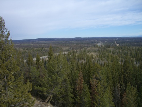
Coming out of Fort Nelson, there is a sign announcing that there are no services for 250km or so. The ‘real’ Alaska Highway begins!

30km from Fort Nelson, I had to make a choice that I had been agonizing over for weeks. I was about 130km from the border of the Northwest Territories. It was very tempting to turn, go to the border, have lunch at the rest stop there (very convenient), come back, and spend the night in Fort Nelson. But most of the road to to Fort Liard, NWT, is gravel and there was a forecast of snow.  So, I knew I’d be encountering mud and potholes and potentially vehicle-damaging conditions. I decided not to make the detour.

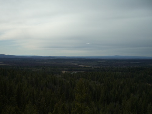
I stopped for lunch at Steamboat Mountain (apparently the mountain looks like a Steamboat, but I couldn’t see it). It was very cold and wet up there, but the views were fantastic!

view from Steamboat Mountain rest area

view from Steamboat Mountain rest area

I passed a herd of caribou a short while down the road:

herd of caribou

herd of caribou

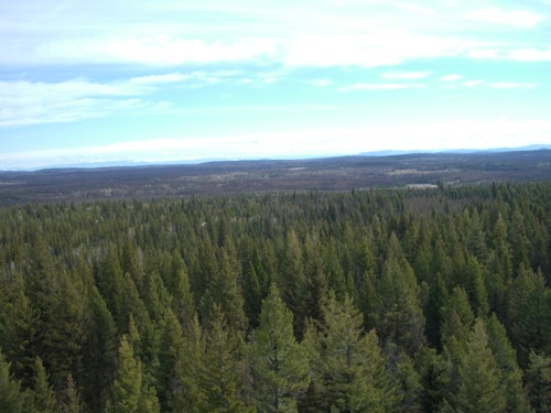
I stopped again at Summit Lake, the highest point on the Alaska highway:

Summit Lake

Summit Lake

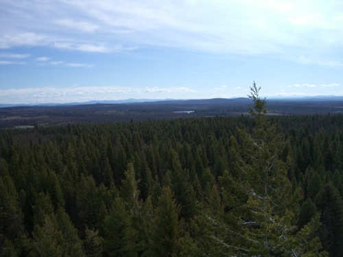
I continued on past one breathtaking peak after another only to be stopped by the last thing I expected to stop me in the middle of the wilderness:

the wilderness red light district?

the wilderness red light district?

The gal at the Fort Nelson Museum told me that I had to stop and take in the view at Muncho Lake, so I did:

Muncho Lake

Muncho Lake

The lake was frozen, but there was enough thaw near shore for me to realise that Muncho Lake is bright blue-green in summer.  So, this might seem like a picture of any other lake, I have a feeling the ice is hiding a real jewel.

The Alaska Highway follows the curve of the lake, so RVers, be prepared to take things slow and to stay as far right in your lane as possible!

I then began to look for a place to spend the night and was suddenly besieged with the sight of something I had never thought I would see in the wild. Let me add a sidebar here that my favourite movie of all time is ‘Dances With Wolves.’ The main character, Lieutenant John J. Dunbar, is heading out into the frontier to see it before it’s gone and there is one animal he is anxious to see, the mighty ‘tatanka’:

Yes, folks, that's a buffalo. There was a herd of them, but this picture came out best.

Yes, folks, that’s a buffalo. There was a herd of them, but this picture came out best.

Thank you to the folks in the car behind me for stopping and therefore, giving me permission to stop too.

I was seriously running out of steam by this point and it was already 4PM (which surprised me!). I was faced with another decision: continue to Liard Hotsprings and spend the night at the campground there (17$ and no hookups) or stop before the springs (free) and pay the day use fee Friday (5$). I chose the latter, stopping at a gravel turnoff with great views just 9km from the springs.

view from my livingroom on Thursday night

view from my livingroom on Thursday night

I knew that Friday night would have to be on hookups, so it just didn’t make sense budget-wise, to pay for a non-hookup site. Two days is just about as long as I can go on my battery. What about the generator, you say. Well, let’s just say that my genset was working just fine when it was tested in Vancouver and was very useful at the Chasm, but it will no longer start. I really don’t think I’m meant to boondock. 🙁

That downer aside, Thursday was a nice , quiet evening. I had bought a book about the Chilkoot Pass history at the Fort Nelson Museum, so I read until the book was done. It was 9:30 and still bright day light out. Thankfully, the loft area is fairly dark, so I was able to conk out in short order.

The Alaska Highway

While being something of a WWII history buff, I’ve always focused on Europe with little attention paid to the conflict in the Pacific. So, a lot of what I’ve learned about the building of the Alaska highway surprised me. Of course, I take some of it with a grain of salt, recognizing the scent of American propaganda, but the facts are not in dispute.

First, let me comment on the various names this road has gone through, of them ‘AlaskaN highway’, ‘Alaska-Canada highway’, and ‘Alcan highway.’ The latter is my favourite as it seems more inclusive. But since the purpose of the exercise was to create an inland route to Alaska, I can accept the decision to go with ‘Alaska highway.’ 🙂

The Alaska highway was commissioned in 1942 a few months after the bombing of Pearl Harbor. There was a very real fear that Japan would attack the west coast of North America. The Japanese even had an outpost just 700mi and change for the Aleutian Islands. The air route across Canada and into Alaska territory was unreliable as were the off shore sea routes. The Alaska highway would serve two goals: provide a secure overland route into the territory and reassure the American public that the Americans were doing everything possible to secure North America against the Japanese.

The building of this highway astounds me. It was done in eight months with very little planning by a team that had no experience in sub-arctic road construction, cold-weather survival, or heavy equipment handling. The American army engineers basically blasted their way through the wilderness and in doing so created a feat of engineering some say is only second to the building of the Panama Canal.

cimg00041

Some 4,000 of the 11,000 men who built the highway were black, working in segregated troops under white commanders.

cimg00241

These men worked against formidable prejudices–that they were too lazy, stupid, and unsuitable to cold climates to be of any use. Yet, they persevered in the hope that they would be rewarded with changed circumstances back home.

cimg0059

Dawson Creek has a relatively new (2007) museum devoted to the building of the Alaska highway. It is located right behind the Mile 0 post that stands in the centre of the intersection of 10th Avenue and 102 Street. Admission is free. Plan an hour and a half to visit the museum in order to take in the 60 minute PBS movie about the building of the highway. This movie is peppered with commentary by actual engineers, both black and white, involved with the project. My favourite part of the museum was the showing of home movies by one of the engineers; they are in colour!

Today, the Alaska highway is shorter and straighter than it was back in 1942. It is paved and lined with all the comforts and trappings of civilization. And, yet, it is still synonymous with adventure.

A friend said to me, about being at Mile 0, that I must be ‘vibrating.’ Oh, yes. Very much so. 🙂

Mile 0

Like Moosejaw, Dawson Creek is a faded old town milking its heyday for all its worth. Even though it sits at Mile 0 of the Alaska highway, it is not the place to place to stock up on supplies and enjoy one last taste of civilization. Locals recommend heading about 75km up the Alaska Highway to Fort St-John, a larger community. It is still a ‘must stop at location’ for history buffs or if only to catch a glimpse of the famed Mile 0 markers:

cimg00031cimg0012

The town is quiet and sleepy. Some folks, like the managers of the Mile 0 RV Park where I’m staying seem jaded to all the folks who come and go while others, like the gals at the tourist info centre or the wonderful manager of Read’s Books, recognize that giddy tourists like me are not only the lifeblood of this town, but also the source of memorable stories.

The city, like Dawson City in the Yukon, is named for George Mercer Dawson, a Canadian scientist and surveyor.

George Mercer Dawson, from one of Dawson Creek's many murals

George Mercer Dawson, from one of Dawson Creek’s many murals

Dawson Creek was originally a farming community, but soon became a railroad hub until it was invaded by American troops in the dead of winter of 1942. That invasion will be described in further detail in my next post, but to show that I’m not exaggerating:

cimg0016

Most of the town being shut tight on Sundays, I only did a walking tour yesterday afternoon. It was disappointing and I quickly gave up. Most of the landmarks on the tour have been destroyed and I got tired of markers saying that ‘such and such was located here in Dawson Creek’s hey day.’

I then went home, refilled my Nalgene water bottle, and set off to walk part of a trail that starts about a block from the RV park and which goes straight through town. Some stretches were quite desolate while others had me going through shanty towns.

Dawson Trail

This morning, I visited the railroad museum that gives a bit of general history of Dawson Creek.

Dawson Creek Visitors' Centre and Museum

Dawson Creek Visitors’ Centre and Museum

This exhibit gave me pause. It makes note of the ‘old-style’ Canadian money:

cimg0057

Old-style?! Heck, I remember how unimpressed I was when these ‘old fives’ were replaced by the blah new version, as well as the kerfuffle when the dollar bill was replaced by the loonie! The former was only about ten years ago and the latter about twenty years ago (already!!!). It’s a bit shocking to be thirty and to see familiar things become antiques! 😀

The rest of what I did and saw belongs in the next post, so keep reading! 🙂

The Chasm to Lake McLeese

This day was like the one from Thunder Bay, starting off great, with no warning of the disaster to come.

I hadn’t had a good night’s sleep in about a month, so imagine my shock on Monday morning when I discovered I’d slept ten hours straight! The chasm turned out to be a great spot for a good night’s sleep, being pitch dark and blessedly quiet.

This was my first time ever waking up somewhere that did not require me to be out by a certain time, not counting Revelstoke that required me to leave because of my non-existent battery issues. I took my time, savouring the crisp, cold morning. I had fretted about how to get out of the site without unhooking, finding the turn to be very sharp for an RV, but the The Milepost, my bible for this journey, kindly informed me that Chasm Road loops back to the 97 highway.

I stopped just 30km from the Chasm to climb up to Begbie Summit, where there is a fire watch station. This was a 10 minute hike that told me that I really need to do more of these if I want to be ready for the Chilkoot. 🙂

cimg0027

cimg0028

cimg0029

cimg0030

cimg0031

cimg0032

cimg0033

cimg0034

cimg0035

cimg0036

cimg0037

cimg0038

cimg0039

cimg0040

cimg0041

cimg0042

cimg0043

cimg0044

cimg0045

My next stop was for lunch at the 108 Mile Ranch site. I’d topped up the groceries at the Save-On-Foods at 100 Mile House, so I had a very nice picnic.

cimg0046

cimg0047

cimg0048

cimg0049

cimg0050

cimg0051

cimg0052

cimg0053

cimg0054

cimg0055

cimg0056

cimg0057

cimg0058

My water levels were getting low, my tanks were getting full, my house battery was ready for a bit of juice, and I had a mountain of laundry to do. So, I decided that a night on full hookups was in order.

Using the Milepost, I determined that the McLeese Lake Resort, between Williams Lake and Quesnel, would be a good place to stop as it boasted full hook-up sites, easy RV access, and wi-fi.

cimg0059

Williams Lake

cimg0060

Williams Lake

Well…

This was a beautiful resort, but really not made for RVs over the size of a class B. I took a turn too sharply to get into my site and clipped the post holding the water outlet, then drove straight over it with the toad. Miranda has a nice scrape down the side of the battery compartment door and one of its closures is dented.

Damage at the site looked really bad and the owners thought they would need to call in for a backhoe to get to the underground leak. I was told that I was looking at a 500$+ repair bill. They were very nice about the whole thing, but I was beyond mortified and freaking out. My trip was over if the bill came to fruition; I’d have to dash straight to Whitehorse to get work.

Several hours passed as I did laundry, puttered around the house, and otherwise tried to keep myself occupied as I waited for the final verdict.

Finally, the groundskeeper came around to announced that he got to the leak with just a couple of spadefuls. As it turned out, the water hose was just that, a flexible hose, not a pipe, and all I’d done was rip a connection apart. It was a two minute repair. As for the post, it seemed pretty rotten and did not factor into the equation when they came up with a bill for me–50$ for the inconvenience and labour. Fair enough. *relieved*

The people at the resort were just so nice about the whole thing. I paid them in cash last night, but still went into the office this morning to make sure that everything was okay. The manager took me around the outside of the office and showed me where someone had just about taken the roof off the porch with their rig! I could tell that she was trying to make me feel better and it worked somewhat. She told me I’m welcome back anytime, but I’m not going back there!

The resort is absolutely gorgeous. I had a nice spot by the water, something that enchanted the kitties. But the ‘pull through’ site was barely so and their wi-fi is WEP encrypted so I couldn’t get on. So, while my night there wasn’t a complete and utter disaster, it won’t bring back pleasant memories. 🙂

cimg0061

Tabitha being absolutely enchanted by the waves on the lake. Love her perch!

cimg00061

The picture of food cooking is a secret message to my former boss. Thanks for the bag, it was delish!

cimg0062

cimg0063

cimg0064

cimg0065

cimg0066

Totem Poles, Parrots, and Fish

Today’s story can best be told in pictures, so this entry serves as only a guide to today’s extensive photo gallery.

First stop on this rainy Saturday morning was the U(niversity of) B(ritish) C(olumbia) Museum of Anthropology. It has been undergoing major renovations for the past six months and only a few exhibits are open. It was still a fantastic tour of BC First Nations art (in the form of lots and lots and lots of totem poles) as well as an interesting exhibit on tribal tattoos and one about ceramicware.

Next, we were off to the Bloedel Conservatory in Queen Elizabeth Park. Thankfully, the sky was only spitting by this point and even hinted at clearing up. Several people had mentioned that this conservatory was a ‘must see’ and I have to agree!

We ended the day in Steveston, which was a much more happening place than it was the last time I went! We walked around, checking out all the kitschy souvenir shops before collapsing in a coffee shop where my friend had a pot of tea and I savoured two (!) caffe macchiatos until we felt that we could walk to a restaurant for dinner. We had initially planned to get fish & chips at a stand recommended by Croft, but it was too cold to eat outside. So, we decided on a sitdown dinner at the Shady Island, where we had a most satisfactory meal of cod fish & chips and a very nice coleslaw. I also indulged in a beer. I don’t know how those fish & chips compared to other Steveston joints, but I was very happy with them.

I am happy to report that I can now get around Vancouver with a minimum of GPS reliance and wrong turns and that a city that once seemed scary and hostile now feels like home.