This post is a bit out of order as I have two other outings to write up, but this was the most exciting. 🙂 The internet has been misbehaving (a territory-wide issue), hence why I’m behind in my posting. Believe me, a lot has been going on and I’m making the most of my nightless summer in Dawson City!
Today is the solstice, the longest day of the year. Up here, the sun sets for just a short moment; it is the night where we come as close to 24 hours of daylight as possible. True 24 hour daylight is found further north, past the Arctic Circle.
Last year, I set as a goal that I would spend this solstice on the Dempster Highway at the Arctic Circle. I didn’t think it was a realistic goal, but it motivated me to at least be north of 60 by June 21st.
Sunday is a short work day for me, 7AM to 9AM, so I decided that a day trip onto the Dempster was in order. I drove 100km up the highway to Two Moose Lake and celebrated the solstice a ‘few’ hours early (I have to get up at 6 tomorrow!) at the southern limit of the tundra, 300km shy of the Arctic Circle. Wow! 😀
My original plan for the day was to just go hiking in Tombstone Territorial Park, but my manager told me to go 30km further north to Two Moose Lake so I could see the tundra. Great advice! I drove straight to the Lake, then did my planned hike on the Grizzly Creek Trail.
The Dempster has a reputation for being a very rough road, but the 100km I drove were easy. There were perhaps two sections with really bad potholes, but, otherwise, it was very smooth going on a road that was more dirt than gravel. My average speed was 70kph, but my return was more at 80 and 90kph since I knew what to expect. If the road is like that all the way to Inuvik, I am not worried about taking Miranda on it. I was disappointed that the first 30km or so are incredibly boring and that there are far too few turnoffs once you start to hit the incredible views! Small quibbles. 🙂
I only drove one seventh of the Dempster and was already struck by the sheer isolation of the land I was driving through. I saw a homestead or two that were obviously self-sufficient, but, otherwise, there is nothing but mountains and tundra as far as the eye can see. It was land a person could disappear in.
The Milepost guide has a section about the Dempster and includes the following helpful information about Two Moose Lake:
Moose can be seen at twilight.
What about the season when there is no twilight?! 😀
Even though I wanted to keep going after the lake, I knew I had a long drive home and an even longer hike planned, so I turned around and headed back into Tombstone Park. I stopped at the campground and information centre to get the latest trail report and to find out if there had been recent bear sightings on the trail (nope).
The day had dawned very grey with heavy clouds and they let loose during the time I was the information centre. By the time I reached the Grizzly Creek trailhead, the sun was out in full force. I always have ‘luck’ with the weather the day I decide to climb a mountain. Hopefully, that streak will hold up with the Chilkoot!
The trail leads to a backcountry campground, but my goal was the observation deck, about halfway. I hadn’t done any reading on the trail, so I didn’t know what to expect and was prepared for anything. My pack had everything I needed to take care of myself if ‘anything’ happened in the bush. I set off at 2PM with an ETA back at the car of 4 or 5 based on the little information the Milepost gave me.
The trail starts off gently, meandering through thick forest and lush vegetation, following the eponymous Grizzly Creek. The going is a bit treacherous as the trail is composed almost entirely of exposed tree branches, which are very slippery. The path slowly and sneakily starts to climb until you reach a staircase. From there, the slope is obvious and it’s a hard haul to the summit, with a patch of rock scrambling. Without exaggeration, the bit leading from the stairs to the top of the rocky area could be described in the same way as the trail from Sheep Camp over of the Chilkoot Pass is described in books, only in extreme miniature.
What impressed me the most was how the trail takes you up above the treeline to fantastic views of the valley below. Standing up at the summit was very humbling; I felt very small and insignificant, but, ironically enough, very much part of the world around me.
The hike down was much harder, jarring my poor knees. I would have twisted my ankles in a couple of spots had I not been wearing proper hiking boots with high tops. But what great practise this was for my next backcountry hike!
At the trailhead, there is a box with forms for ‘voluntary self-registration.’ The purpose is to find out how many people go into the park and for what reason so that the Yukon government can best manage the land. I filled in some of the info, such as where I was going and how long I planned to be there, but did not fill out the personal information as I am growing a bit paranoid in my older age ( 🙂 ). Upon returning to the trailhead, there is a second form to complete, which asks if there were changes made to the itinerary or length of journey. One of the last questions is “Did you encounter any wildlife?” I replied “Yes, mosquitoes.” Next question was “Why do you think this encounter occurred?” To which I replied “I didn’t wear bug spray.” I’m such a smart ass. 😀
I was back at the car by 4, where I inhaled a snack of yoghurt and a granola bar before heading back home, about an hour and a half away. I am very amused by the fact that I had to stop halfway and take a short nap! I haven’t had a real solid night’s sleep in weeks and have been surviving on catnaps, which explains my exhaustion. 🙂
What a fantastic day it was! I am so thrilled that I got a ‘taste’ of the Dempster this year; it will tide me over until next year, when I will finally go to Inuvik.


shortly after leaving pavement

shortly after leaving pavement

heading into the Tombstones

heading into the Tombstones

heading into the Tombstones

heading into the Tombstones

the car was fully brown by the time I got home; the mud was about a half inch thick in parts!

icy lake

Never thought I would be so close to Inuvik!

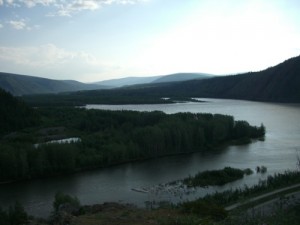
Two Moose Lake

tundra


I fell in love with this peak and want to climb it one day!

Tombstone mountains


Tombstone mountains

Tombstone mountains


Tombstone mountains

Tombstone mountains shrouded by fog

you start off at tree level and then climb up above the treeline; very impressive!

first sign of moose; I learned to watch my step!

the first part of the trail is tricky, with tons of slippery roots underfoot waiting to trip you

there was water before the bridge, but none under it. LOL!

still among the trees

the view makes it easy to forget the climb

upwards and onwards

a mini Chilkoot preparation (exaggerating!)

climbing

still climbing

above the tree line

I love this cloud; it started off looking like a pig and morphed into a horse!