Canyon View Trail, Campbell River

When I asked my Christmas dinner hosts for ideas on day excursions from Campbell River, the first thing they mentioned was the Canyon View Trail, just outside of Campbell River. Today I awoke to a day off and good hiking conditions (overcast with sunny patches and plus four) so I decided I would go check out this trail.

The Canyon View Trail is very easy to access. Follow highway 28 towards Gold River for about ten minutes (a mere 3km from downtown) to the John Hart power plant. That’s the official trailhead, but I saw two other places to park and access the trail before that. The power plant is on BC Hydro property, but much of the trail is actually in Elk Falls Provincial Park.

One of the things that appealed to me about this trail is that it is a loop. It is about six kilometres long and relatively easy; most of the hike is along established pathways. There is one sudden elevation change that I will discuss below, but, otherwise, it’s a very easy walk.

From the power plant and facing the river, you can either go left or right. I went right and feel that this is the way to best experience the Canyon View Trail as the trail starts off in a rather boring fashion and then, just near the end of the loop, suddenly climbs high above a canyon for stunning views. What a great reward for all those kilometres already hiked!

One thing spoiled the mood in the woods today; an atrocious stench along some stretches of the trail. The riverbank was littered with the rotting carcasses of hundreds of huge salmon. There has been a lot of flooding in that area, so I am assuming the fish all died of natural causes from being caught on dry land after the water receded. I’ve included a picture of  dead fish, the least icky one I took, in the following picture gallery; viewer discretion is advised.

From the trailhead, if you go right the trail will pretty much follow the highway and you will need to walk on asphalt for a bit to get to a bridge to cross the river. The trail is definitely a lot more woodsy on the other side and you will have the chance to walk by some old growth Douglas firs. You will circle a BC Hydro installation and continue until you see the power plant ahead of you, on the other side of the river. Shortly thereafter, the trail will climb dramatically until it takes you to a narrow steel walkway spanning an impressive canyon. The walkway covers a natural gas pipeline.

I was surprised by how well I did on that bridge as it was surprisingly bouncy. I did keep an elbow on the railing most of the time, but I wasn’t clinging to anything and I took the time for plenty of shots. Might our intrepid author have actually conquered her height phobia?

After the bridge you will head down towards the power plant and will actually have to cross it to get back to the parking lot. The noise coming from it was deafening and two hours later my ears are still ringing! I’d suggest moving along rather than stopping to take photographs.

My only complaint about the trail is that it isn’t very well marked. I recommend stopping at the parking lot at the entrance to Elk Falls, which you will pass if you starting hiking from the power plant. There is a map there of the extensive trail network in the area which will help guide you along the correct route. Had I not done this, I would have had no idea where to go from this parking lot. As it turns out, it’s where you need to leave the woods for the short walk along the highway. The intuitive thing to do is to keep following the woodsy trail, which ends in a very sudden drop.

I very much enjoyed the Canyon View Trail and look forward to exploring other trails in the vicinity of Campbell River.

Look out for this sign on the right side of the highway if you want to park at the power plant. It's easy to spot if you're driving at the speed limit.

Look out for this sign on the right side of the highway if you want to park at the power plant. It’s easy to spot if you’re driving at the speed limit.

CIMG0001

CIMG0002

CIMG0003

This is pretty much what I imagined 'wild' Vancouver Island would look like.

This is pretty much what I imagined ‘wild’ Vancouver Island would look like.

CIMG0006

CIMG0007

fly fisherman

fly fisherman

CIMG0010

CIMG0011

CIMG0012

There were all kind of things marked in this sandy cove.

There were all kind of things marked in this sandy cove.

a retaining wall

a retaining wall

CIMG0019

CIMG0020

CIMG0021

close up of the a shallow, clear-as-a-mirror river just before a small fall

close up of the a shallow, clear-as-a-mirror river just before a small fall

The flat calm made it hard to believe this is a river.

The flat calm made it hard to believe this is a river.

CIMG0026

CIMG0030

CIMG0031

CIMG0034

CIMG0035

CIMG0036

Mushrooms

Mushrooms

CIMG0038

CIMG0039

CIMG0040

map of the trail network

map of the trail network

CIMG0043

CIMG0044

Fishermen

Fishermen

Fighting the current

Fighting the current

Campbell River takes fishing seriously; this is a wheelchair accessible fishing platform. Impressive!

Campbell River takes fishing seriously; this is a wheelchair accessible fishing platform. Impressive!

this was a shrine to a young boy

this was a shrine to a young boy

bamboo

bamboo

the not-so-nice part of the trail

the not-so-nice part of the trail

this gull fought the current for a bit...

this gull fought the current for a bit…

then decided to just go with the flow until he finally flew off

then decided to just go with the flow until he finally flew off

lovely beach

lovely beach

CIMG0058

CIMG0059

CIMG0060

the least gruesome dead fish picture

the least gruesome dead fish picture

"Two roads diverged in a yellow wood..."

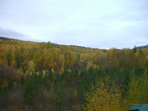
“Two roads diverged in a yellow wood…”

Dead bamboo that I mistook for a nanosecond for tarantula legs. *shudders*

Dead bamboo that I mistook for a nanosecond for tarantula legs. *shudders*

CIMG0066

CIMG0067

some cool fungus

some cool fungus

close-up of the jewel-like fungus

close-up of the jewel-like fungus

all the yummy varieties of salmon found in the campbell river

all the yummy varieties of salmon found in the campbell river

what a lovely place for a picnic, right next to a noisy power installation

what a lovely place for a picnic, right next to a noisy power installation

having grown up near a hydro-electric dam I know that this sort of flat calm right next to active water spells danger

having grown up near a hydro-electric dam I know that this sort of flat calm right next to active water spells danger

ducks not caring about the warning signs

ducks not caring about the warning signs

one of the very rare trail markers

one of the very rare trail markers

Douglas fir

Douglas fir

CIMG0077

CIMG0078

CIMG0079

CIMG0080

CIMG0081

the passage of eons, immortalized in layers of stone

the passage of eons, immortalized in layers of stone

part of the way up the canyon...

part of the way up the canyon…

with this ahead of you

with this ahead of you

keep your eye out for this brief flash of blue hidden within the emerald foliage

keep your eye out for this brief flash of blue hidden within the emerald foliage

CIMG0088

CIMG0089

CIMG0090

CIMG0091

CIMG0092

one heck of a drop....

one heck of a drop….

CIMG0094

CIMG0095

CIMG0096

CIMG0097

CIMG0098

CIMG0099

CIMG0100

worth the climb and, especially, the whole stopping over thin air on a flimsy bridge thing

worth the climb and, especially, the whole stopping over thin air on a flimsy bridge thing

CIMG0102

CIMG0103

CIMG0104

this sign amused me

this sign amused me

CIMG0106

cute little staircase

cute little staircase

CIMG0108

CIMG0109

this part of the trail reminded me of wandering around Alcatraz Island!

this part of the trail reminded me of wandering around Alcatraz Island!

CIMG0111

Back on the Horse

As promised, Miranda was ready to go by 10 on Thursday. She’d undergone an oil change, thorough mechanical inspection, and been washed. I hooked up without fanfare and slowly drove out of there.

In my exploration of Pemberton, I had concluded that the AC Petroleum gas station was the most RV friendly, so I went there to fill up and then across the road to the information centre next to which there is a sani-dump and a potable water tap.

It had rained all morning, but the sky had really cleared up, and I had ideal conditions for getting back on the proverbial horse as I drove out of Pemberton. There was one hill with a steep grade and a couple of hairpin turns that was going to make or break me. I approached it bravely, heart in my throat, geared down, and got down safely, having to tap my brakes only once. They held up fine. 😀

I was caught in a bit of conundrum, time-wise. It was too late to get to Horseshoe Bay, grab a ferry, and arrive at Croft’s place in daylight, but it was much too early to stop for the day. I decided to stop at the Starbucks near the Canadian Tire in Squamish to do some online stuff then go park at Shannon Falls to hike and kill a few hours before pulling into the Walmart for the night.

There was no really convenient place to park at the Canadian Tire, so I took up a bunch of spots and tried to make myself as inconspicuous as possible, but I ended up not feeling comfortable enough there to stay as long as I could have on the Starbucks connection. So, after a catch up session with Will and a quick check of my email I proceeded to Shannon Falls Park.

There, I paid the 3$ day parking fee, squared Miranda away, and went off to explore the falls and trail network. It was a nice way to wile away a few hours, but I was exhausted and ready to stop for the day.

Three o’clock is too early in my book to park at Walmart for the night, but I decided to make an exception to my rule provided the Walmart folks were okay with overnight RVers. The Walmart in Squamish is really not set up for big vehicles, so I wound up having to park almost in the middle of the lot, taking up a full row of spots. When I came out of the rig and saw a Walmart employee coming up towards me, I figured that he was going to tell me to get lost. But no, he just came over to save me the trouble of going in to ask for permission to park and to let me know that I was parked fine!

The long evening passed quickly as I watched movies and set off on a three hour marathon blog post writing session in eager anticipation of being able to post with pictures. I went into the Walmart a few times to get various sundries and the fourth time the greeter told me “I know you’re parked in that motorhome. Don’t feel obliged to spend the night in here!” LOL!

It wound up being a pretty good night in Squamish, quiet and reasonably dark by Walmart standards. It started to rain in the wee hours of the morning.

Tantalus Lookout

Tantalus Lookout

Tantalus Lookout

Tantalus Lookout

Tantalus Lookout

Tantalus Lookout

Tantalus Lookout

Tantalus Lookout

A family picture. That Fiver-er is a Glendale Titanium, a line Glendale still produces even after dropping the Royal Classics

A family picture. That Fiver-er is a Glendale Titanium, a line Glendale still produces even after dropping the Royal Classics

Tantalus Lookout

Tantalus Lookout

Tantalus Lookout

Tantalus Lookout

Tantalus Lookout

Tantalus Lookout

Tantalus Lookout

Tantalus Lookout

CIMG0173

CIMG0174

CIMG0175

CIMG0176

CIMG0177

CIMG0178

CIMG0179

CIMG0180

CIMG0183

CIMG0184

CIMG0185

Plans Undone and a Chasm Respite

I  had a pretty good night at the turnout even though I practically woke to a gale, with Miranda rocking back and forth. I had coffee and the rest of the bannock, then set off under a clear a sky at about 10.

My first stop of the day was Kitwanga where there is a side road that goes through ‘town’ and loops back to the Cassiar. I took this loop road because it announced a nearby Parks Canada site of a First Nations battleground. I enjoyed the walk down to and up the hill.

Lunch was had at a pull-out just before Smithers and then I headed to my destination for the night, an RV park just east of Houston, 300km shy of Prince George. I followed the signs for the park, all of which proclaimed it was open… except for the one after the last turn that ended in a shut gate.

I found myself in a situation not unlike that back in Manitoba, caught in a turn where I couldn’t unhook. This time, backing up with the toad and doing a million point turn wasn’t even an option seeing as the road was very narrow and bordered by ditches. The only possibility I could see was to cross a culvert and turn around in a big field. I got out and checked the culvert, finding it sturdy. The field was pot holey and definitely not a place I would have voluntarily taken Miranada and the toad into, but I felt confident that I could get turned around without doing any damage or having to unhook. I was right. Whew!!!

With all of that, I forgot that I was low on fuel and left civilization without gassing up. 50km from Houston, I woke up in that regard and realised that I was staring at a bunch of long uphill stretches with no gas in sight and a gas gauge needle dipping deeply into the red. This was the first time I have ever come close to running out of gas and I figured I’d used up all my luck for the day. Both the GPS and the Milepost were in agreement that the nearest gas station in either direction was too far away.

So, you can imagine that when I saw a sign in the distance announcing gas, I thought it was a mirage. 😀

As it turns out, it was a pump on a native reserve, not a proper gas station. But there was a sign announcing prices for status and non-status folks, so I figured I could gas up there. The pump was in the middle of a perfectly-sized roundabout, full-serviced, and offered the cheapest gas I’d seen since Whitehorse (1.03).

I wound up being there almost an hour seeing as my credit card would not go through after several attempts. I called the company to see if there was a security hold on the card, but no. The very helpful person I spoke to suggested that the problem might be with the POS terminal, not my card. The attendant was a young gal fairly new on the job and I coached her on how to call for POS support. Sure enough, there was a glitch with their system and she was walked through the process of resetting the terminal. My card went through fine after. Had the problem been on my end, I would have used an alternate method of payment, but since the problem was theirs and it was more convenient to pay with my credit card than with another method I had no problem with the time the transaction took. Moreover, I think I did the girl a favour showing her what I knew about POS machines.

Like the day before, I pushed on in search of a non-advertised RV park or other legal overnighting option, but found none. I reached the end of the Cassiar and turned east onto Yellowhead highway 16, which also does not permit boondocking. Here, the reason is obvious with frequent billboards reminding people, especially women, that the road is nicknamed ‘The Highway of Tears’ because many young women have disappeared on it. There is a strong possibility that a serial killer is stalking this desolate stretch of highway.

The sun was very low in the sky by the time I passed Vanderhoof, so I decided to just take the plunge and limped all the way to the Walmart in Prince George, covering in total that day more than seven hundred kilometres!

There were signs at the Walmart that overnight parking is not permitted, but there were so many RVs parked that I just ignored the signs. I’m such a rebel!!!

It was COLD in Prince George and I turned on the furnace for the first time. It would have been nice the other nights, but this night it was no luxury.

I didn’t sleep at all; it was just too light, noisy, and COLD. I was cranky and just wanted to get out of civilization. Last time I was in Prince George I stayed for a few days at Les Doll’s place, but that detour didn’t fit in with my itinerary this time around. I instead decided to go back to the Chasm and spend two nights there.

The morning was spent running errands, including a quick run into Canadian Tire where I actually ran into Les. What are the odds?!

It was sooo good to be back on the road, even with the construction coming out of Prince George. It was nice in a way to be back in familiar territory, especially since I was out of fresh water and driving with full black and grey tanks. My first stop of the day was going to be Quesnel, which has some of the best RV facilities in the west; a large day parking area, dump station, and potable water pump, all free. Taking on water was fine, but my holding tanks were frozen solid!

From Quesnel, I drove straight back to the Chasm, knowing I was racing the light. I pulled into the turnoff at bang on six. The turnoff was in worse shape than it was in the spring, very muddy and without a single level spot. I unhooked and drove Miranda into an area below the turnoff with a couple of fairly level places to park if you don’t mind doing a bit of a dance with your RV to get into the right position. I didn’t mind the work, finding this spot more suitable for a long stay than is the turnoff.

I spent a quiet evening reading and watching a movie. I had a rare good night’s sleep.

The next morning was bright and cold… and my fresh water tank was frozen solid. I had to laugh. I grabbed a bucket and made a couple of trips down to the creek to get some slush to melt for washing purposes and as well as some drinking water from the spring to boil for drinking. Life without amenities suits me, I’ve discovered. Had I not needed to haul water I would have probably not had any exercise that morning.

It was a quiet, homey day, where I got caught up on my sewing (!) and cleaning. Some people walked past Miranda a few times to take in the view of the Chasm, but no one bothered me. I was relaxed and pleased that I was only a day away from the ferry terminal, two days from Croft’s. My journey was practically over and I could relax…

This impressive toadstool was by the side of the Cassiar turnoff

This impressive toadstool was by the side of the Cassiar turnoff

CIMG0081

CIMG0082

CIMG0083

CIMG0084

CIMG0085

CIMG0086

CIMG0087

CIMG0088

CIMG0089

CIMG0090

CIMG0091

CIMG0092

I would not want to run into that guy in the mask in a dark alley...

I would not want to run into that guy in the mask in a dark alley…

CIMG0094

CIMG0095

CIMG0096

CIMG0097

CIMG0098

CIMG0099

CIMG0100

CIMG0101

CIMG0106

CIMG0107

CIMG0108

reaching the end of the Cassiar highway

reaching the end of the Cassiar highway

CIMG0111

CIMG0114

Moricetown Canyon

Moricetown Canyon

Moricetown Canyon

Moricetown Canyon

lunch stop in Smithers

lunch stop in Smithers

lunch stop in Smithers

lunch stop in Smithers

break at a rest area

break at a rest area

CIMG0120

break at a rest area

break at a rest area

in case that's not clear, the monument to which this plaque is attached features a stone from an English castle reputed to be the birthplace of King Arthur!

in case that’s not clear, the monument to which this plaque is attached features a stone from an English castle reputed to be the birthplace of King Arthur!

Miranda and the toad at the Chasm

Miranda and the toad at the Chasm

the Chasm

the Chasm

truck's still there from last time...

truck’s still there from last time…

I love this view...

I love this view…

not a bad spot, really

not a bad spot, really

CIMG0131

dawn of one of the worst days of my life

dawn of one of the worst days of my life

Fall Colours

I was happy to get today off, but not so much as when I realised that, hey, my day off coincided with my one year anniversary of being on the road! I didn’t hesitate to pack up a picnic and head back up the Dempster to Tombstone to see the fall colours! I was a little bit late as the colours are fading, but I did manage to get a few good shots. I also decided to rehike the Grizzly Creek Trail, sans 30lb pack, and discovered along the way that I’m sick and tired of climbing UP and I need a break from climbing mountains. 😀 To add to my disappointment, the pictures I took from the summit are all washed out and don’t do justice to the landscape. Bah. 🙂

En route, I stopped at the Klondike River Lodge for a coffee and ran into my Chilkoot guides yet again! Not much later, I ran into my cyclist friends whom I’d met on the Top of the World highway. What a small world for such big country!

On the way back, I picked up a young guy I’d met at the camping this week. He looks like a complete punk, but he had wowed me with his impeccable manners. I hate to judge a book by its cover, but I wouldn’t have picked him up had I not met him before. I’m glad I did because he had the funniest story to tell. We somehow got on the subject of stupid questions tourists asked and his favourite was “What do you guys do with the ice bridge?” To which he replied: “We take a big saw and cut it up into chunks. Every resident of Dawson has to keep at least three chunks in their freezer all summer and then the bridge is reassembled the next winter.” Hee hee!

It was a grey, drizzly day, but, still, what a spectacular anniversary!

CIMG0113

CIMG0125

CIMG0126

CIMG0127

CIMG0128

CIMG0129

CIMG0130

CIMG0131

CIMG0132

CIMG0133

CIMG0134

This map showing the elevation change for the Grizzly Creek Trail was not up when I first hiked here. Had it been, I'm not sure I would have ventured up with my 30lb pack! It's actually not that far off from the elevation change from Sheep Camp to the summit, but it's STEEPER!

This map showing the elevation change for the Grizzly Creek Trail was not up when I first hiked here. Had it been, I’m not sure I would have ventured up with my 30lb pack! It’s actually not that far off from the elevation change from Sheep Camp to the summit, but it’s STEEPER!

there was another one of these guys hanging out by itself in the bushes

there was another one of these guys hanging out by itself in the bushes

CIMG0147

CIMG0150

CIMG0151

CIMG0154

CIMG0156

CIMG0157

CIMG0159

CIMG0161

CIMG0164

CIMG0165

CIMG0168

CIMG0169

okay, this was worth the climb :)

okay, this was worth the climb 🙂

The Cost of the Chilkoot Trip

Several people have followed my link to the Sea to Sky website page about the Chilkoot hike and commented that the cost for the trip is very high. Someone even used the word ‘exorbitant.’ I couldn’t disagree more; the trip was a bargain!

In cold hard numbers, the trip cost $1569.75 and covered essentially eight full days, for a total per diem of $196.22.

Just think, I had no responsibility whatsoever beyond getting my personal items together. Everything else was taken care of for me, from coordinating train schedules to gathering together the necessary permits to putting together meals. This enabled me to focus on getting in shape.

All meals except for the dinners in Skagway and Whitehorse were provided, including an additional snack for the train ride to Alaska. We were extremely well fed, with fresh produce every day, and tons of treats being brought in for us at Lake Bennett. I met a couple on the trail who were eating freeze-dried food exclusively and going through about $80 worth of the stuff each per day, for a total of $160 that closely reaches Sea to Sky’s per diem!

We had two guides for a group of five guests when the industry standard is one guide for five guests. I chose to help them out on occasion with meal preparations, doing dishes, or hauling water (they were, after all, only human and as tired as the guests!), but I didn’t have to, which turned a very strenuous hike into something more closely resembling a ‘vacation.’

All transportation from Whitehorse and back was included and we even did a 5K detour on the way back to drop me off at my cousin’s place (I hiked out to the South Klondike Highway on the day out).

Finally, the hike required some equipment I don’t have and didn’t feel I could justify purchasing for this one trip when storage is at such a premium in the RV, so Sea to Sky provided me with a larger pack, an inflatable sleeping pad, a tent, and a hiking pole, saving me hundreds of dollars.

In short, it’s easy to look at a number like the one on the website and blink, but when you add it all together, it’s surprising that the cost for the trip is so low!