Montreal Urban Legend

Jacques Cartier Bridge seen from Montreal

Until this afternoon, I believed like many Quebecers, that the Jacques-Cartier Bridge was designed by Gustav Eiffel, or that the bridge was a gift from France. Not without reason:

The finials are not ‘Eiffel towers’, but sure do resemble them! They measure 13′ and weigh 6 tons!

Bonus picture of the day:

Olympic tower seen from the Jacques Cartier bridge through the suicide prevention barrier

Pointe-à-Callière (and random shots)

My grand-mother wanted to do something special with me this week and suggested we go to a museum. I hadn’t been to Pointe-à-Callière in at least fifteen years, so that’s what I suggested. This museum is built over the foundation of some of the oldest buildings in Montreal and the highlight is to go under ground and walk through the old stone foundations.

It’s been easy to see my grand-mother this week since she moved to Chambly and is now living a kilometre away from my mother’s house. I walked over this afternoon and she greeted me with a light lunch, then we headed to Montreal.

Pointe-à-Callière is located in the most scenic part of the island, the Old Port. Walking through the cobblestone streets is just like being in Europe. The whole area is slowly being gentrified and more new structures are springing up, but I don’t think we will ever lose the look and atmosphere of the Old Port.

Our tour of the museum started with an excellent multi-media presentation about highlights in Montreal history, from pre-history to today. I found it to be a little too upbeat and it glossed over the more negative issues like the French/English disputes, but I’m being a tad picky. For a twenty minute overview, it painted a pretty accurate portrait.

The special exhibit this fall is one about Rapa Nui, Easter Island, and I enjoyed it very much. I discovered that I knew almost nothing about Easter Island, such as the important fact that it is still inhabited today!

We then headed downstairs and and took a quick jaunt through the foundations, the highlight of which are the sewer systems that were way ahead of their times. This archaeological site takes you through more than 360 years of history, from a 17th century Catholic cemetery to an 18th century marketplace to the 19th century sewer systems. The whole thing is rather labyrinthine and we had to get directions back to the surface!

Merci pour la belle journée, grand-maman!

lunch was pretty enough for a picture!

lunch was pretty enough for a picture!

my grand-mother's balcony overlooks my childhood... only back then, in the '80's, there were only fields and trees instead of all those houses

my grand-mother’s balcony overlooks my childhood… only back then, in the ’80’s, there were only fields and trees instead of all those houses

my mother worked in that building for much of my childhood and we lived right across from it

my mother worked in that building for much of my childhood and we lived right across from it

Montreal skyline from the Champlain bridge

Montreal skyline from the Champlain bridge

Old Port--contrast of the old and the new

Old Port–contrast of the old and the new

more of the Old Port

more of the Old Port

Pointe-à-Callière

Pointe-à-Callière

IMGP0961

old foundations

old foundations

more old foundations

more old foundations

in 1900, Montreal was Canada's metropolis

in 1900, Montreal was Canada’s metropolis

the old sewer system

the old sewer system

the old sewer system with a photograph showing what the exit would have looked like

the old sewer system with a photograph showing what the exit would have looked like

more old sewage systems

more old sewage systems

walking out is like entering Europe

walking out is like entering Europe

we walked out onto a movie set!

we walked out onto a movie set!

crossing the Victoria bridge, the first to connect the island of Montreal to the South Shore

crossing the Victoria bridge, the first to connect the island of Montreal to the South Shore

Champlain Bridge seen from the Victoria Bridge

Champlain Bridge seen from the Victoria Bridge

the ugliest building on the South Shore!!!

the ugliest building on the South Shore!!!

I love the street signs in Chambly because all the street names are explained; Lebel was named after a mayor

I love the street signs in Chambly because all the street names are explained; Lebel was named after a mayor

Jasper and Environs

I decided to go into Jasper today with the toad, much like I did when I visited Banff. There was a museum exhibit I did not want to miss, not believing my good fortune at being here in time for it, and I also wanted to check out some of the surrounding area. It made better sense to do that with the smaller vehicle with good gas mileage! This is going to be rather a long post, but I don’t feel that the individual items deserve their own posts. I’ve interspersed some photos into the text, but do check out the gallery in its entirety for more details.

Jasper townsite is about 75km from Hinton, nearly an hour away. It was almost noon when I pulled up to the park gates. I was asked if I was stopping in the park (no pass is required if you drive straight through) and, if so, for how many days. I replied that I would be going in and out today and would be going through tomorrow. I don’t know if it was the lateness of the hour or what, but I was given a pass that’s good till 4PM tomorrow for the daily rate!

en route to Jasper townsite

Like Banff, Jasper is located within a national park. Unlike Banff, Jasper has an industry outside of tourism so it has a stable economic base that does not fluctuate with the seasons. My impression of Jasper is that it is a more humble version of the ritzy tourist town (think Banff, Aspen, Whistler…). It’s a bit grittier than I would have expected, store and gas prices are reasonable, and homes tend to be modest… even though a tiny bungalow costs a half million dollars!

downtown Jasper

The town is small and doable on foot, so I just parked at the entrance and did a sort of figure eight through the streets, taking in the major landmarks. I noted that there is well-marked RV parking in town.

Jasper Library

I was eager to get to the museum to see the exhibit about the explorer David Thompson.

Jasper museum

Thompson is an explorer who charted most of the continent in the early 19th century. His maps are legendary. He was a man who understood that he was witnessing sweeping changes to the British North American regime and the birth of a nation. He was the one who charted a usable route through the Rockies, securing what is now British Columbia, a land the Americans were eying. Thompson’s explorations united eastern and western Canada and helped shaped the nation that was born on July 1, 1867. Like many great men, he died penniless and insignificant. A sad end to a remarkable story.

excerpt from Thompson’s diary

The Jasper museum is excellent! It charts the history of the park and the townsite from prehistory to today. Like many towns, Jasper’s heyday ended with the demise of the railroad era. Today, the Jasper Lodge attractions the wealthy and famous sort of folk that were the original visitors to Jasper until reliable roads made the area and townsite more accessible. It was around the 1950’s that the idea came to charge people an entrance fee into the park.

gate into Jasper, circa 1950

After getting my fill of the museum, I grabbed some lunch and then headed out of town to travel the Maligne Lake Road.

Jasper train yard

This road leads to the swanky Jasper Lodge, as well as several geographic landmarks of interest: Maligne Ravine, Medicine Lake, and Maligne Lake. Maligne comes from old French that means ‘wicked’, thus named by a man of the cloth who had a difficult time making a portage.

Maligne Valley

Maligne Ravine was my favourite outdoor part of the day. The sinuous, claustrophobic channel with its thunderous waterfalls and turquoise pools filled me with wonder. I practically hung off the side of the bridges to try to get a sense of the sheer drop with my camera, but I don’t think I really captured it. The view was such that I didn’t even think about the height factor. I just wanted to take it all in!

Maligne Ravine

Next stop was Medicine Lake, so called by the local natives because they felt the lake contained medicine, or magic. This lake looks like a lake in the summer, but drains in the fall, leaving only shallow pools! The mystery has been explained, but it’s still quite a sight to behold!

Medicine Lake

Medicine Lake

Shortly after Medicine Lake, I encountered a pair of moose:

The final stop of the day was Maligne Lake, considered one of the most beautiful in Canada. It was worth the nearly one hour drive from Jasper townsite!

Maligne Lake

I did pop over to the Jasper Lodge on the way back, but I was most certainly not dressed to be walking around a posh property inconspicuously, so I was a bit shy and only got a shot of it from a distance:

Jasper Lodge

Coming home, I finally had a wildlife sighting I’ve been eager for. I’ve seen deer, caribou, moose, bison, foxes, wolves, bears, and more, but I’ve never seen a wild sheep before! Thank you construction for slowing down traffic!

sheep

I ended the day by popping into Hinton to scope out the best gas station at which to fuel up Miranda tomorrow (the Shell on the north side) and to get some groceries (VERY nice IGA!).

When I got home, I hooked up the water and sewer hoses after filling the fresh water tank. I dumped the holding tanks and will put away everything once I’ve had a long shower tonight. The car is already hooked up, so there won’t be too much to do to get ready tomorrow. I’ll have a lot of ground to cover and many things to see, so I don’t want to waste too much time puttering around here.

Finally, here is a shot of the campground:

Hinton/Jasper KOA

en route to Jasper townsite

en route to Jasper townsite

en route to Jasper townsite

en route to Jasper townsite

en route to Jasper townsite

en route to Jasper townsite

en route to Jasper townsite

en route to Jasper townsite

en route to Jasper townsite

en route to Jasper townsite

downtown Jasper

downtown Jasper

downtown Jasper

downtown Jasper

I'd love to bank here!

I’d love to bank here!

Nearly freezing out, with snow on the ground, and they're mowing the lawn!

Nearly freezing out, with snow on the ground, and they’re mowing the lawn!

Jasper Visitors' Centre

Jasper Visitors’ Centre

downtown Jasper

downtown Jasper

downtown Jasper

downtown Jasper

IMGP0650

Jasper Library

Jasper Library

IMGP0653

playground with a view

playground with a view

IMGP0655

Jasper museum

Jasper museum

banner promoting the Thompson exhibit

banner promoting the Thompson exhibit

IMGP0659

IMGP0660

IMGP0662

IMGP0663

IMGP0664

IMGP0665

IMGP0666

IMGP0667

gate into Jasper, circa 1950

gate into Jasper, circa 1950

IMGP0669

IMGP0670

IMGP0671

IMGP0672

IMGP0673

IMGP0674

David Thompson

David Thompson

IMGP0676

IMGP0677

IMGP0678

IMGP0679

IMGP0680

excerpt from Thompson's diary

excerpt from Thompson’s diary

IMGP0682

IMGP0683

IMGP0684

IMGP0685

IMGP0686

IMGP0687

IMGP0688

IMGP0689

painting of Thompson portaging in the Kootenays

painting of Thompson portaging in the Kootenays

IMGP0692

IMGP0693

IMGP0694

IMGP0696

IMGP0697

IMGP0698

IMGP0700

IMGP0701

Jasper train yard

Jasper train yard

IMGP0703

IMGP0704

IMGP0705

Maligne Valley

Maligne Valley

Maligne Valley

Maligne Valley

Maligne Valley

Maligne Valley

Maligne Valley

Maligne Valley

Maligne Valley

Maligne Valley

Maligne Valley

Maligne Valley

Maligne Ravine

Maligne Ravine

Maligne Ravine

Maligne Ravine

Maligne Ravine

Maligne Ravine

Maligne Ravine

Maligne Ravine

Maligne Ravine

Maligne Ravine

Maligne Ravine

Maligne Ravine

Maligne Ravine

Maligne Ravine

IMGP0719

Maligne Ravine

Maligne Ravine

Maligne Ravine

Maligne Ravine

Maligne Ravine

Maligne Ravine

Maligne Ravine

Maligne Ravine

Maligne Ravine

Maligne Ravine

Maligne Ravine

Maligne Ravine

Maligne Ravine

Maligne Ravine

Maligne Ravine

Maligne Ravine

Maligne Ravine

Maligne Ravine

IMGP0729

Maligne Ravine

Maligne Ravine

Maligne Ravine

Maligne Ravine

Maligne Ravine

Maligne Ravine

Maligne Ravine

Maligne Ravine

Maligne Ravine

Maligne Ravine

teahouse at the Maligne Ravine

teahouse at the Maligne Ravine

Medicine Lake

Medicine Lake

Medicine Lake

Medicine Lake

IMGP0739

IMGP0740

Medicine Lake

Medicine Lake

Medicine Lake

Medicine Lake

Medicine Lake

Medicine Lake

Medicine Lake

Medicine Lake

IMGP0745

IMGP0746

moose

moose

IMGP0748

Maligne Lake

Maligne Lake

Maligne Lake

Maligne Lake

Maligne Lake

Maligne Lake

Maligne Lake

Maligne Lake

Maligne Lake

Maligne Lake

Jasper Lodge

Jasper Lodge

Jasper Lodge

Jasper Lodge

sheep

sheep

Hinton/Jasper KOA

Hinton/Jasper KOA

Miranda at the Hinton/Jasper KOA

Miranda at the Hinton/Jasper KOA

Driving the Dempster: Tuktoyaktuk

In the summer, the Dempster highway ends in Inuvik. In the winter, it continues as an ice road to the hamlet of Tuktoyaktuk (“looks like a caribou”). Located only about 100km from Inuvik on the edge of the Beaufort Sea, Tuk is home to a few hundred Inuvialuit habitants who keep their traditional ways alive. Touring the hamlet, whether you get there by plane, boat, dog sled team, or snowmobile, is one of the most popular things to do when visiting Inuvik, if only for the opportunity to dip one’s toe in the Arctic Ocean.

As I said, I picked Arctic Adventure tours to get me to Tuk since the other option didn’t have as many other tours happening. I am very satisfied with my experience. I know other members of the tour were not and I think that the reason for that is they just aren’t used to how things are done in the north. What may look like disorganization to an outsider is actually flexibility in the face of the weather or missing supplies. Living up here has really taught me to be more mellow and just let things come to me in their own time.

While there weren’t enough people for a tour on Wednesday, there were too many off us on Thursday. It was quite possibly the biggest group ever sent to Tuk at one time and I was a bit worried that we’d miss out on things, like the toe dipping, with a group that size. But I said nothing, allowing the trip to unfold, which it did in a most satisfactory manner.

The group was driven by minivan to Inuvik airport where we were loaded into a tiny plane. As each person got on, the tail of the plane began to sink nearer and nearer to the ground. I don’t think we could have stuffed one more person into that thing!

It took about a half hour to fly to Tuk. We got amazing aerial views of the Mackenzie Delta, Inuvik, pingos, and Tuk. I didn’t learn my lesson the last time I flew in a small aircraft and still took a lot of pictures, which meant that I was bright green when we landed. I just about kissed the ground. 😀

first good glimpse of Tuk

There were two guides waiting for us in Tuk, one older lady and one about my age. The former would take a dozen people in her van while the latter would take three in a pickup truck. I managed to get onto the small tour with a couple about my age, escaping  the older German crowd.

We hadn’t even left Tuk airport that we learned our guide was born and raised in Tuk, has lived Outside, and has decided to put down her roots here. She is Inuvialuit, raised in the traditional ways, and a competent whale and caribou hunter. Most Inuvialuit her age do not have that level of competency with the old skills and passing them on to her son is very important to her. She can’t imagine any other place but Tuk where she can live the life she grew up with, eat the foods she is accustomed to, and be with those she loves.

I’m going to make a parenthesis here to gloss over a thorny Canadian issue: that of our First Nations people. While Canada has made great strides in this regard, the fact that we still have a department of Northern and Indian Affairs speaks to great lengths about how the First Nations are treated here. That said, a great portion of the Arctic is now within the Inuvialuit Settlement Region, leading from an agreement to return to the Inuvialuit people some of what was taken from them by European settlers. They now have complete control over their land and can manage its resources as they see fit. This issue came up many times during our Tuk visit.

Our guide took us around Tuk very slowly, showing us the key features of the community. The first thing we saw was an old warning station dating from the Cold War. It is still in use today, but largely automated. Her brother, based in Cambridge Bay, gets to come home once in a while and do maintenance work.

We then stopped at a pingo. A pingo is a mound of earth covered ice that only forms in a permafrost area, resulting from the waterbasin below being pushed up. Tuk is home to the largest concentration of pingos in the world and boasts the second largest (which is not the one we stopped at, but I did get a shot of it from the air). Since we were such a small group, we were able to get out of the truck and climb to the top of the pingo to get some good views of town. Looking at my photos, what strikes me is how much more picturesque Tuk looks in them than it did in person.

on top of the pingo

Back in the truck, we passed a summer smoke house, the baseball field, and three churches! The guide wanted to show us the second one, but it was being renovated, so we stopped in the third. From the outside it seemed quite derelict, but the damp interior was cozy and obviously well loved and used often. I admired a piece of patchwork made from seal fur, with the different colours coming from different parts of the seal.

And then came the highlight of the tour!

standing in the Arctic Ocean!

I can now say that I have touched all three of Canada’s coasts! The icing on the cake was the jelly fish washed up on shore.

Our guide mentioned that Tuk is one of the only coastal communities in the NWT to get a lot of driftwood (it floats up from the Mackenzie), so they have a constant supply for fires, building, tool-making, and crafts.

Next, the guide took us to the fur shop, where locals crafts are made available for sale. I really wish I’d had room in my budget for a pair of beaded slippers (moccasins where I come from). I still own the pair that were made for me as a child, but they obviously don’t fit any more!

The next part of the Tuk tour isn’t for the faint of heart. We got to descend 30 feet underground into the community freezer.

looooong way down

Hmm… I don’t like heights or enclosed places, but how often am I going to have the chance to see what permafrost looks like???

At the bottom, there are three hallways with about 25 rooms each. The ice house isn’t used much anymore (“Just about everyone has their own freezer”), but the guide’s father still uses his. I was able to go in and see what he keeps in there, including a whole seal used for dog meat.

The freezer has to be cleared out in early fall, soon as the snow comes. This is because snow is such a good insulator that it actually gets warm down in the ice house and everything melts in winter!

We climbed back up and I was never so grateful to see blue sky again. 😀 Three days later and I’m still sore from the climb!

Back in the truck, we saw some of the community infrastructure. There is a grocery store/pharmacy/gas bar/post office. A gallon jug of milk is about $15 and gas is about $2.50 per litre (about $10 per gallon). Our guide says that the cost of gas for boats and shells for rifles makes hunting cost nearly as much as buying groceries.

The town has no bank (“most people here wouldn’t even know what to do with one”), so the grocery store cashes cheques. Mail isn’t reliable, but does arrive eventually. Many residents buy things online and our guide laughed as she said that folks are quick to find places with cheap shipping that are then exploited until the sellers wise up and increase prices. You can get anything to Tuk, it’ll just cost ‘a little more’ than it does Outside. There is also satellite television, cell service, and high speed internet.

Tuk also has a nurse-staffed clinic open only for emergencies (they are short-staffed), a fire hall run by volunteers, an RCMP detachment with four officers who come in on two year rotations, and a taxi service that doubles as an ambulance (Suburban van=place for a patient to lie down in the back if needed), but there are no restaurants although there are a couple of bed and breakfasts. There is talk of turning one abandoned building into a small café.

There is a school, kindergarten through grade 12, from which our guide graduated, although she did do some of her schooling Outside. The older grades used to be shipped to Inuvik and the guide said that that was better since the Tuk school only offers the most basic courses. She had to do her sciences by correspondence and plans to send her son Outside to make sure he gets the best opportunities possible. Her biggest critique is of the retired teachers who come up just for the money and who are not willing to provide badly needed extra curricular activities. Aurora College, a post-secondary institution, has a small branch in Tuk, also.

Tuk also has a community centre, a swimming pool, and a youth centre. The pool is staffed only by Outsiders and is frequently closed because of lack of staff. There is talk of training a local person to do this job as it would be much more sensible and cost effective.

garlic-shaped building is a swimming pool

The youth centre has an interesting history. Back in the mid-1990’s the Molson company staged a major rock concert up in Tuk as a publicity stunt, with four big bands coming up to play. One of these bands, Metallica, donated the money for the youth centre. How cool is that?!

Next, our guide generously took us to her parents’ property to introduce us to the sled dogs, give us a demonstration in the use of a whale harpoon, and show us where the family prepares some of their traditional foods. We also saw her mother’s flowers; she is the only person in Tuk to grow flowers in her garden.

The tour ended at the docks where we saw a cargoship headed for other coastal communities. We’d been in a Tuk a full two hours and it was time to head back to the airport. On the way there, I asked our guide about a road I had seen from above that appeared to head well out of town. Turns out that it leads to a good source of gravel, but that there are talks of extending it as an all-year road to Inuvik! The hold up is that the easiest and cheapest route goes through the boundary of a sacred lake that would be polluted if made too accessible. Our guide is certain that the issues will be resolved and that she will see the completion of the road in her lifetime. An all-year road to Tuk would change life there dramatically and, according to our guide, for the better.

The flight back to Inuvik was much smoother and shorter than the flight in, so I felt more elated than nauseated when we landed. 🙂

My trip to Tuk cost $400 and was well worth both the cost and the anticipation. I’ve been wanting to do that trip for so long and it was even better than I had dreamed it would be. Traveling to Tuk is one of the cheapest excursions out of Inuvik and is a truly rewarding experience.

the minivan that took us to the airport

the minivan that took us to the airport

our plane, the tail of which lowered considerably as each one of us got on

our plane, the tail of which lowered considerably as each one of us got on

cramped quarters :)

cramped quarters 🙂

Inuvik airport

Inuvik airport

Inuvik airport

Inuvik airport

this puny plane made ours look slightly more respectable

this puny plane made ours look slightly more respectable

takeoff over the Mackenzie Delta

takeoff over the Mackenzie Delta

the Dempster

the Dempster

the Dempster

the Dempster

Inuvik

Inuvik

Inuvik

Inuvik

Inuvik

Inuvik

Inuvik

Inuvik

flying over the Mackenzie Delta

flying over the Mackenzie Delta

flying over the Mackenzie Delta

flying over the Mackenzie Delta

flying over the Mackenzie Delta

flying over the Mackenzie Delta
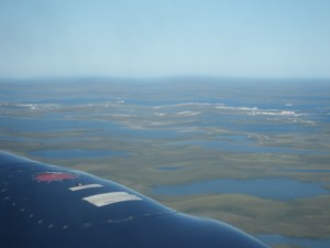
flying over the Mackenzie Delta

flying over the Mackenzie Delta

flying over the Mackenzie Delta

flying over the Mackenzie Delta

flying over the Mackenzie Delta

flying over the Mackenzie Delta

first glimpses of Tuk

first glimpses of Tuk

the second largest pingo in the world

the second largest pingo in the world

approaching Tuk

approaching Tuk

the Arctic Ocean!

the Arctic Ocean!

the Arctic Ocean!

the Arctic Ocean!

the Arctic Ocean!

the Arctic Ocean!

first good glimpse of Tuk

first good glimpse of Tuk

Tuk airport

Tuk airport

James Gruben summed up as a fun guy.

James Gruben summed up as a fun guy.

James Gruben

James Gruben

our guide was actually able to pronounce the Inuvialuit name

our guide was actually able to pronounce the Inuvialuit name

a Cold War era monitoring centre (remember, we're practically on top of Russia here!)

a Cold War era monitoring centre (remember, we’re practically on top of Russia here!)

exterior of the housing authority

exterior of the housing authority

just a normal little village, with street names, houses, even stop signs

just a normal little village, with street names, houses, even stop signs

on top of the pingo

on top of the pingo

on top of the pingo

on top of the pingo

on top of the pingo

on top of the pingo

on top of the pingo

on top of the pingo

summer smoke house

summer smoke house

the baseball field

the baseball field

this church is being restored

this church is being restored

this church is most definitely not abandoned!

this church is most definitely not abandoned!

the cozy interior of the church belies its weathered exterior

the cozy interior of the church belies its weathered exterior

seal pelt/fur patchwork

seal pelt/fur patchwork

IMGP0319

Trans Canada trail marker

Trans Canada trail marker

looking out at the Beaufort Sea

looking out at the Beaufort Sea

jellyfish!

jellyfish!

standing in the Arctic Ocean!

standing in the Arctic Ocean!

exterior of the ice house entrance

exterior of the ice house entrance

exterior of the fur shop, which holds local crafts

exterior of the fur shop, which holds local crafts

IMGP0329

looooong way down

looooong way down

IMGP0331

fish

fish

cut up bits of flesh

cut up bits of flesh

seal (used to feed the dogs)

seal (used to feed the dogs)

crystallin snow

crystallin snow

permafrost

permafrost

looooong way up

looooong way up

base of the ladder

base of the ladder

grocery store, gas bar, and pharmacy; also serves as a bank of sorts

grocery store, gas bar, and pharmacy; also serves as a bank of sorts

the fire hall

the fire hall

the school (K thru 12)

the school (K thru 12)

the community centre

the community centre

garlic-shaped building is a swimming pool

garlic-shaped building is a swimming pool

our guide explains the whale harpoon; the orange ball is keeps the whale carcass afloat

our guide explains the whale harpoon; the orange ball is keeps the whale carcass afloat

looking out towards the main part of Tuk

looking out towards the main part of Tuk

the guide's family cuts up meat on that table (simply covered with cardboard) and they boil muktuk (beluga skin and blubber) in that black drum

the guide’s family cuts up meat on that table (simply covered with cardboard) and they boil muktuk (beluga skin and blubber) in that black drum

cargo containers on a shipping barge headed for other coastal communities like Paulatuk and Sachs Harbour

cargo containers on a shipping barge headed for other coastal communities like Paulatuk and Sachs Harbour

odd doorways at the Tuk airport

odd doorways at the Tuk airport

our plane was a wee bit bigger :)

our plane was a wee bit bigger 🙂

one side of the plane seemed like dusk and the other like bright daylight!

one side of the plane seemed like dusk and the other like bright daylight!

one side of the plane seemed like dusk and the other like bright daylight!

one side of the plane seemed like dusk and the other like bright daylight!

one side of the plane seemed like dusk and the other like bright daylight!

one side of the plane seemed like dusk and the other like bright daylight!

yet another unfortunate i-before-e-instead-of-the-other-way-around misspelling by the government of the NWT

yet another unfortunate i-before-e-instead-of-the-other-way-around misspelling by the government of the NWT

this little guy died of natural causes and is displayed at the Inuvik airport

this little guy died of natural causes and is displayed at the Inuvik airport

Driving the Dempster: Inuvik

Inuvik, ‘place of man’ is a hot and gritty industrial town. Its edges are worn and the whole place feels dirty and run down. It is most certainly not a ‘tourist town’, not even with it being a destination. I expected the town to be flat and barren, but it’s actually hilly and surrounded by trees as far as the eye can see. The biggest surprise, given the appearance of the town, is just how friendly the locals are.

It’s a peculiar place to end up after all the excitement of driving the Dempster to reach it. There are no museums or other cultural attractions, no shops worth mentioning, no restaurants. The only real thing to do is to get out, by plane or boat. Inuvik’s motto is apt: the end of the road is only the beginning.

The town is a planned community conceived in 1953 to serve as an administrative centre that would replace Aklavik, prone to flooding. Inuvik gained village status in 1967, became a town in 1970, and was linked to the rest of Canada via the Dempster in 1979, making it the northernmost community that can be traveled to year-round by car. The population is just over 3,000, of which the majority are Inuvialuit and other First Nations.

One of the most famous features of the town is its Utilidor system. These above-ground pipes carry potable water and sewage to the buildings in town. By having these pipes above ground two things are achieved: 1) the permafrost is not disturbed and 2) the pipes are easy to get to if anything needs to be fixed.

utilidor system going into a house

The most famous landmark is the Our Lady of Victory Church, shaped like an igloo. I was unable to tour the inside, but the exterior is most impressive!

another shot of the Igloo Church

While not tourist-friendly, the town appears to be very livable. There are a new hospital, a dentist, an impressive rec complex, schools, a community greenhouse, and two supermarkets. Coming from a town that has only boutiques, not stores, I was quite jealous of the ‘Northmart’ which sells everything one could want at reasonable prices. I’ve heard a lot of complaints about the price of groceries in Inuvik, but coming from Dawson I found no reason to complain! Things do become much more expensive in the winter, however; a loaf of bread can cost $5!

Homes in Inuvik run the gamut, from shacks to pretty bungalows that would not be out of place in the best neighbourhoods ‘Outside.’ Most homes and buildings are on pilings to keep them from melting the permafrost. Most people seem to have pick up trucks or SVUs, but there are a few other brave souls who do the Dempster in sedans and sub-compacts.

I spent my first two nights in Inuvik at the Happy Valley Campground. It claims to be ‘downtown’ but is actually ‘within walking distance of downtown.’ The whole installation is a contradiction. The RV electrical hookups are obviously kept up, but the tent area consists of a few tent pads haphazardly set up on a fairly level patch of dirt (at least, the area has a splendid view of the Mackenzie river). The showers sparkle, but water is kept out by curtains black with mould. The grass is kept trimmed, but the entrance has potholes you could drop Canada into. At $15 for a tent, though, it is a bargain, considering that the other campground with showers is outside of town and more than $20 a night!

tent set up at Happy Valley

My first stop in Inuvik was the visitor information centre where the attendants are super friendly and helpful. There are some interesting displays there about the Inuvialuit and Gwich’in people, as well as Inuvik and the Mackenzie Delta. There, I got information tours to Tuktoyaktuk and then I found myself wondering how I was going to spend the days and hours until my tour when I realised that beyond getting out of town, there wasn’t much to see or do.

First things first, I made inquiries about Tuk tours and decided on Arctic Adventure Tours because they had a few lined up. I wanted to give myself as many opportunities as possible since I’d come such a long way! I was tentatively booked for a Wednesday 3PM tour and was heading out of the info kiosk, located across from the Igloo Church, when I witnessed a spectacular accident–a Jeep plowed straight into a parked car!

After that excitement, I went off in search of dinner/groceries (so glad I had the ability to cook for myself), drove around town for a bit, and went to bed early.

Wednesday’s Tuk tour was canceled because not enough people signed up. I wiled away the hours driving around town, checking out the few shops, and spending time sitting in a chair at the campground with a pot of juniper tea while overlooking the Mackenzie’s east channel. Wednesday was a true ‘vacation’!

Thursday, I moved to the Arctic Chalet resort, just outside of town. The folks who operate this b&b and cabin property also run the Arctic Adventure Tours. The owner, Judi, offered me a room for $60! At that price, it was worth getting at least one night in a proper bed! The room was beautiful and bright, with a private deck overlooking a lake and a kitchen and bathroom shared with one other guest. It’s one of the nicest places I’ve ever stayed. What a bargain! I spent a few hours reading and then it was time to leave on the Tuk tour.

my room at the Arctic Chalet

I was beat when I came back and it was so nice to be able to make a proper meal, have a hot shower, then sit out on a deck with a book. I even watched some television before bed! The bed was soooo comfortable and I got in a solid seven and a half hours; the best sleep I’ve had in months. I left the Arctic Chalet around 9:30 on Friday and the rest of that day will follow two posts from now.

IMGP0220

the western arctic information centre

the western arctic information centre

cute little houses

cute little houses

the famous Smarties houses

the famous Smarties houses

utilidor system going into a house

utilidor system going into a house

the store that sells everything, A-Z, appliances to zippers!

the store that sells everything, A-Z, appliances to zippers!

Igloo Church

Igloo Church

another shot of the Igloo Church

another shot of the Igloo Church

Inuvik Community Greenhouse

Inuvik Community Greenhouse

Boot Lake Park

Boot Lake Park

Transcanada Trail info

Transcanada Trail info

map of Boot Lake

map of Boot Lake

channel to Boot Lake

channel to Boot Lake

halfway back across this bridge I realised what I was doing; this life has made me so much less fearful of silly things like high bridges!

halfway back across this bridge I realised what I was doing; this life has made me so much less fearful of silly things like high bridges!

all the graves are neatly listed

all the graves are neatly listed

Inuvik cemetery

Inuvik cemetery

Inuvik cemetery

Inuvik cemetery

"the grace of a tundra swan": what a lovely epitaph

“the grace of a tundra swan”: what a lovely epitaph

IMGP0247

IMGP0248

IMGP0249

my kind of cemetery

my kind of cemetery

one of the prettiest and best landscaped homes in Inuvik

one of the prettiest and best landscaped homes in Inuvik

Sir Alexander Mackenzie elementary school

Sir Alexander Mackenzie elementary school

Midnight Sun Rec complex

Midnight Sun Rec complex

Midnight Sun Rec complex

Midnight Sun Rec complex

tent set up at Happy Valley

tent set up at Happy Valley

views from the Happy Valley Campground

views from the Happy Valley Campground

views from the Happy Valley Campground

views from the Happy Valley Campground

View from the tent; it was too windy to put the fly on!

View from the tent; it was too windy to put the fly on!

midnight at Happy Valley

midnight at Happy Valley

I was worried about rain, so I tarped the tent. Love those tent platforms; they make it so much easier to get out of bed!

I was worried about rain, so I tarped the tent. Love those tent platforms; they make it so much easier to get out of bed!

11:30PM at Happy Valley

11:30PM at Happy Valley

midnight at Happy Valley

midnight at Happy Valley

midnight at Happy Valley

midnight at Happy Valley

midnight at Happy Valley

midnight at Happy Valley

my room at the Arctic Chalet

my room at the Arctic Chalet

view from my deck at the Arctic Chalet

view from my deck at the Arctic Chalet

deck entrance in my room at the Arctic Chalet

deck entrance in my room at the Arctic Chalet

guest cabin at the Arctic Chalet

guest cabin at the Arctic Chalet