Driving around Flagstaff last night gave me the impression that it’s not an easy city to drive in. I kept on missing my turns and had to do long detours to get turned around because of the railroad that divides the city. This morning, in the light of day, it wasn’t any better.
There wasn’t anything I particularly wanted to see in Flagstaff, so at reader Sandra’s suggestion, I decided to go spend part of the day in Sedona, a short distance away. Well, it took longer to get out of Flagstaff than to actually get to Sedona!
GPS directions and the paper map told me to take Beulah Blvd, or route 89, to Sedona. So far so good. Until I hit construction and a sign that said, ‘Road ahead closed, take I-17 and exit 337.’ I was at a dead end and had to reverse until I could find a place to turn around. Had I been in the rig, I would have had to unhook and reverse a giant motorhome for about a quarter of a mile!
I finally got turned around and looked for detour signs. There were none. I could see I-17, but no on ramps. My GPS was of no use. The paper map wasn’t detailed enough. Siri had no idea what I wanted. I finally pulled into a parking lot and saw a police officer standing by his patrol car sipping a coffee. I asked him how to get to I-17 and he told me that the gas station over there could sell me a map. Gee, thanks! *rolls eyes*
On the way to the gas station, I passed a lady walking and asked her. She had no idea how to direct me. I made it to the gas station and asked the attendant. He said the on ramp was near Walmart. So I drove around Walmart a bit and finally found the on ramp.
I drove down I-17 until I got to exit 337. Guess what was there? A sign that said, ‘Sedona detour, exit here.’ Seriously, Flagstaff?!
Had I been in the motorhome today, I really doubt I would have made it to Sedona as I would have been caught in dead ends several times and would have been fed up with having to unhook and get myself turned around. For a tourist destination, Flagstaff has a lot to learn about road signage.
When I finally got on the way to Sedona, I enjoyed the drive down a very steep twisty road (the kind that I hated in the RV). We dropped several thousand feet in elevation quite quickly.
I was surprised upon entering Sedona to find tons of signs announcing free three-hour parking all around the main tourist strip. Quite unexpected! I parked and then walked up and down the main street looking into shops, checking out restaurants, and eventually came to the visitor info centre. The city itself is quite unremarkable, but the surrounding landscape is very beautiful! Sedona had a good vibe to it. I felt very relaxed there.
A very helpful lady at the visitor centre gave me some info on hiking trails to check out in the afternoon, telling me that I needed to stay longer to explore Sedona’s 300 miles of trails! She also told me that there is $5 per day fee to hike in the area, but that a number of other passes are accepted, including my interagency pass! She gave me a hang tag for it, something I could have used at Craters of the Moon.
I then headed across the street to the Life is Good store, hoping to replace my now much too big ‘All who wander are lost’ tee-shirt. I found several shirts with the phrase on it, but the only one that had a colour and cartoon on it that I liked was a lady’s size L. The sizing is ample, so I needed at most a medium and didn’t feel like paying $32 for a tent I wouldn’t want to wear in public. Oh, well. I pass Life is Good stores every so often and will keep trying.
It was only just past 11:00 by this time, but I was ravenous, so I decided to hunt down lunch. When I found a well rated restaurant serving rattlesnake, my decision on where to dine was quickly made. That’s all I have to say about that in this post with respect to those of you with sensitive constitutions. For the curious, here’s a review of my lunch.
After lunch, I wanted ice cream seeing as the temperature was now infernal. Most places wanted $5 or more for a small scoop, but I finally found a place that wanted a more reasonable $3.75. I got a scoop of espresso and it tasted exactly like a Tim Horton’s iced cap!
I was then ready to walk off my lunch, so I headed off for a trail head. I wasn’t really dressed for the climate (denim capris and a cotton tee-shirt) and only equipped to carry half a gallon of water, so I didn’t have any ambitious goals except to explore the hillside. I found myself in a warren of hiking trails, all poorly marked, and eventually turned back, certain that I would get lost. I mean, after a few turns, one cactus and pile of red rocks looks pretty much like another! 😀 I still managed to spend about an hour before making my way back to the trail head.
There, a man came up to me and asked if I was visiting from out of town. I cautiously said yes. He said that if I didn’t mind going all the way back up the road to the first round about and coming back down the other side of the divided highway, I just had to do the short Yavapai hike up to a scenic viewpoint. Thank you!
I did exactly that and found a short, but still a bit technical, hike up to a fantastic viewpoint of Sedona’s red hills. I am so grateful to that lovely man and his beautiful and sweet German shepherd! And thank you, Sandra, for making sure I didn’t miss out on this lovely town!
-

-
I LOVED the drive down. Just put the truck in low gear and occasionally moved over to let the Speedy Gonzalezes pass me.
-

-
Tons of these signs in Sedona!
-

-
I’ve never seen Turkish street food!
-

-
How lovely of the town to provide public restrooms.
-

-
Lovely fountain.
-

-
An ugly Not All Who Wander tee-shirt. 🙁
-

-
!!!
-

-
On a back street, looking towards the hills.
-

-
Yuuumm.
-

-
Yay for a hang tag at last!
-

-
‘Healing in progress, please stay on the trail.’
-

-
Lots of trail options.
-

-
I didn’t realise that the earth covering is essentially a bio-organism.
-

-
I wanted to do the courthouse butte loop, but it was too ambitious for this afternoon. I wound up combining a few different short loops.
-

-
One of the rare obvious bits of trail.
-

-
No mountain bikes beyond this point. Big fines!
-

-

-

-
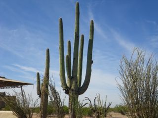
Spiky stuff.
-

-
Cairns marking the trails.
-

-
Officially worried about getting lost at this point. 🙂
-

-
Courthouse Butte.
-

-
This is the kind of van I’d like to convert…
-

-
Another dizzying web of trails.
-

-
Lichen-covered rock.
-

-
Very big, sharp, orange spikes.
-

-
Courthouse Butte and Bell Rock Butte.
-

-
A spire.
-

-
After quite a clamber up a rocky cliff, I found the trail again…
-

-
Interesting bush, with its red branches.
-

-
This is nopal, the stuff I ate in Texas that traumatized me. Can you see its fruit?
-

-

Sedona really charmed me and was much more affordable than expected. I could have easily found a hotel under $50 a night in the area. But unfortunately, border day is coming up fast and I had to make tracks. Yet, there was more magic to be found a short distance down the road.